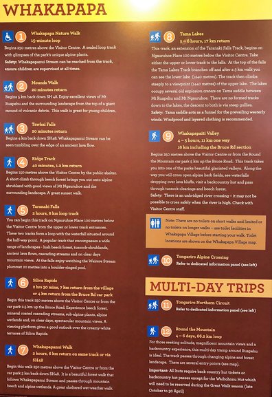
Although the best one day walk in the world, the Tongariro Crossing isn’t all that the Central Plateau has to offer anyone wanting to explore the area. There are many walks that fit all ages and all fitness levels with views that go on forever and you’ll need more than a day to explore them all. You can either drive or catch shuttles from National Park or your accommodation may also offer this. Your first stop should be the iSite where there is information on not only the walks but the history of volcanic activity in the area and the fauna and flora that calls this place home.
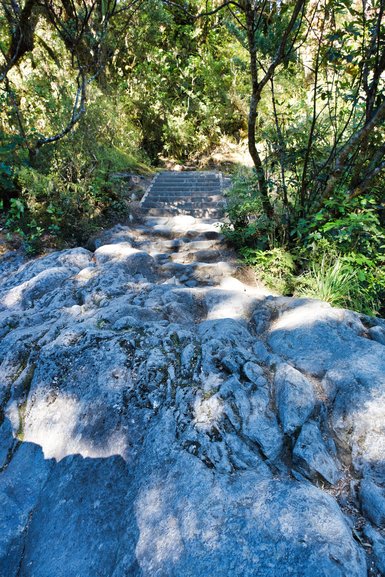
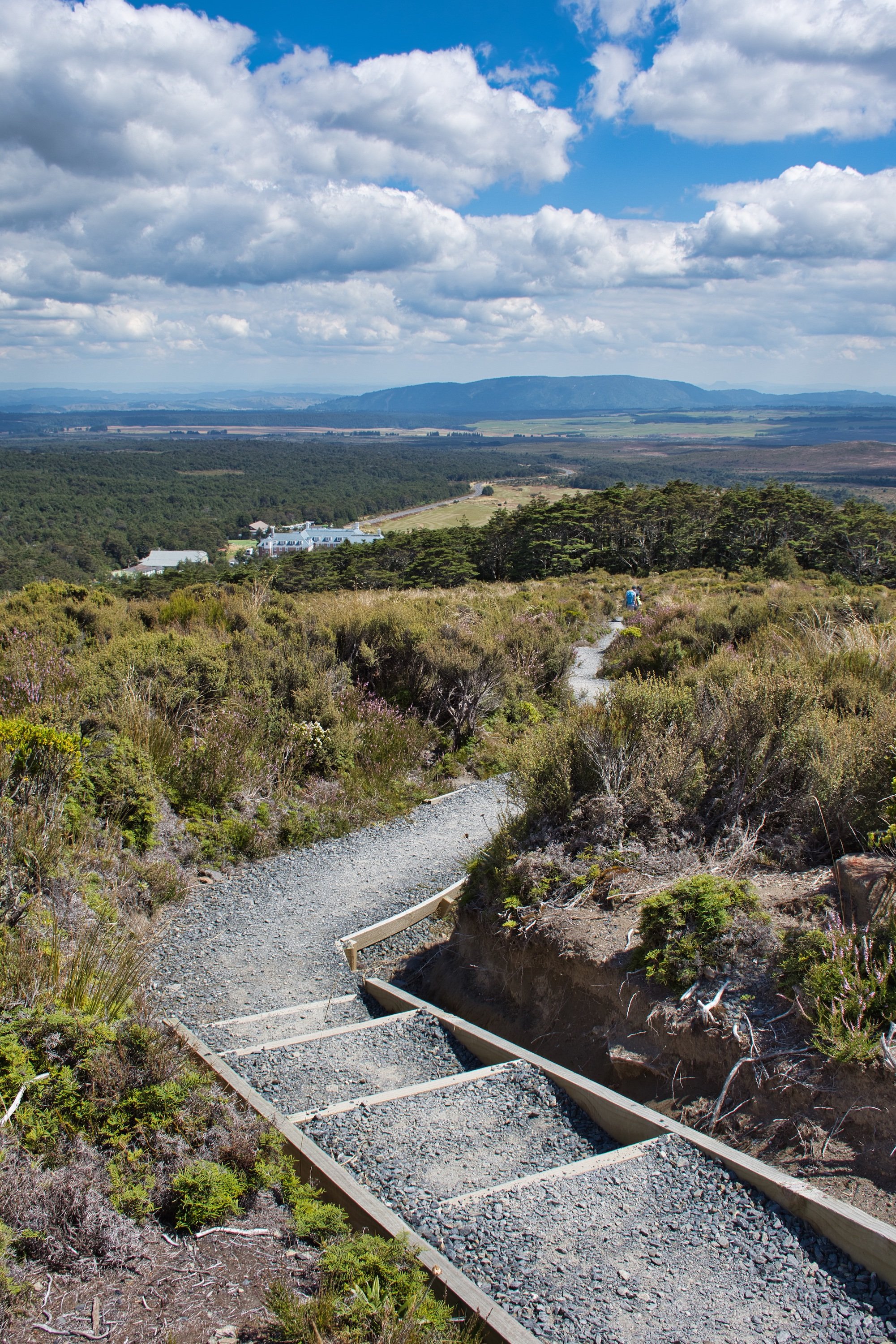
The Ridge Track is a 40-minute return one-way track. A great short walk it's just 150m past the Visitor Centre. It’s uphill 600m but you have great views of Tongariro and Ngauruhoe especially from two-thirds of the way up and the views from the top are as far as the eye can see. The first half of the track passes through beech forest before opening out into alpine scrubland and it is here that you have steps helping the incline. It's also a popular spot for sunsets as well.
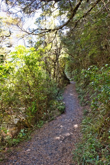
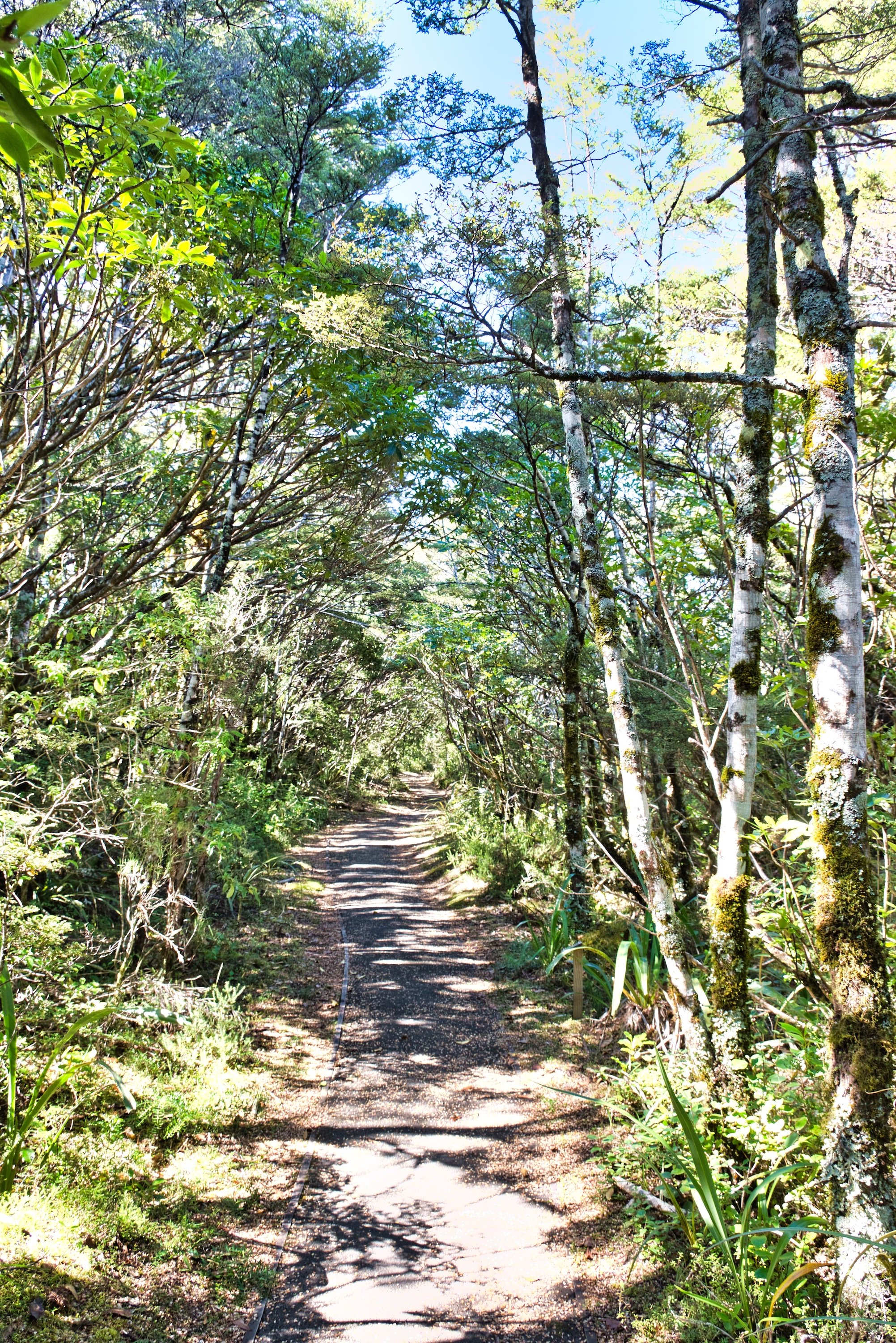
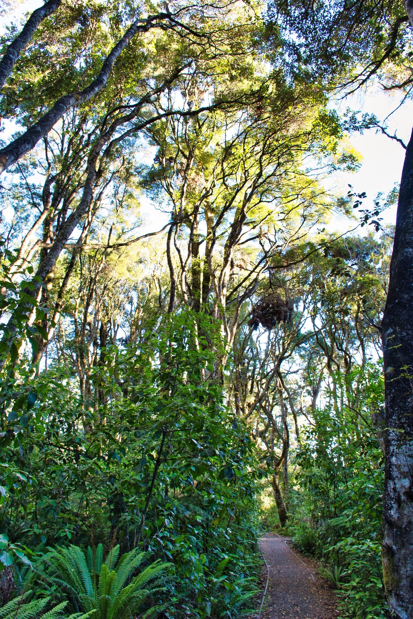
The Whakapapa Nature Walk is a 15-minute loop walk, that is sealed for wheelchairs and strollers. It is here you can see the park’s unique alpine plants and surrounding landscape. It starts 250m above the Visitor Centre opposite the fire station.
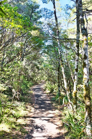
The level path of the Whakapapa Nature Walk
It has information plaques on the plants in the area and has a side track down to the Whakapapanui Stream, although this has steps and uneven ground which isn't suitable for strollers or wheelchairs.
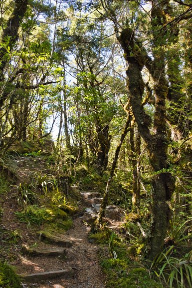
Going back up from the Nature Track Loop
The rough track and steps leading back up to the Whakapapa Nature Walk
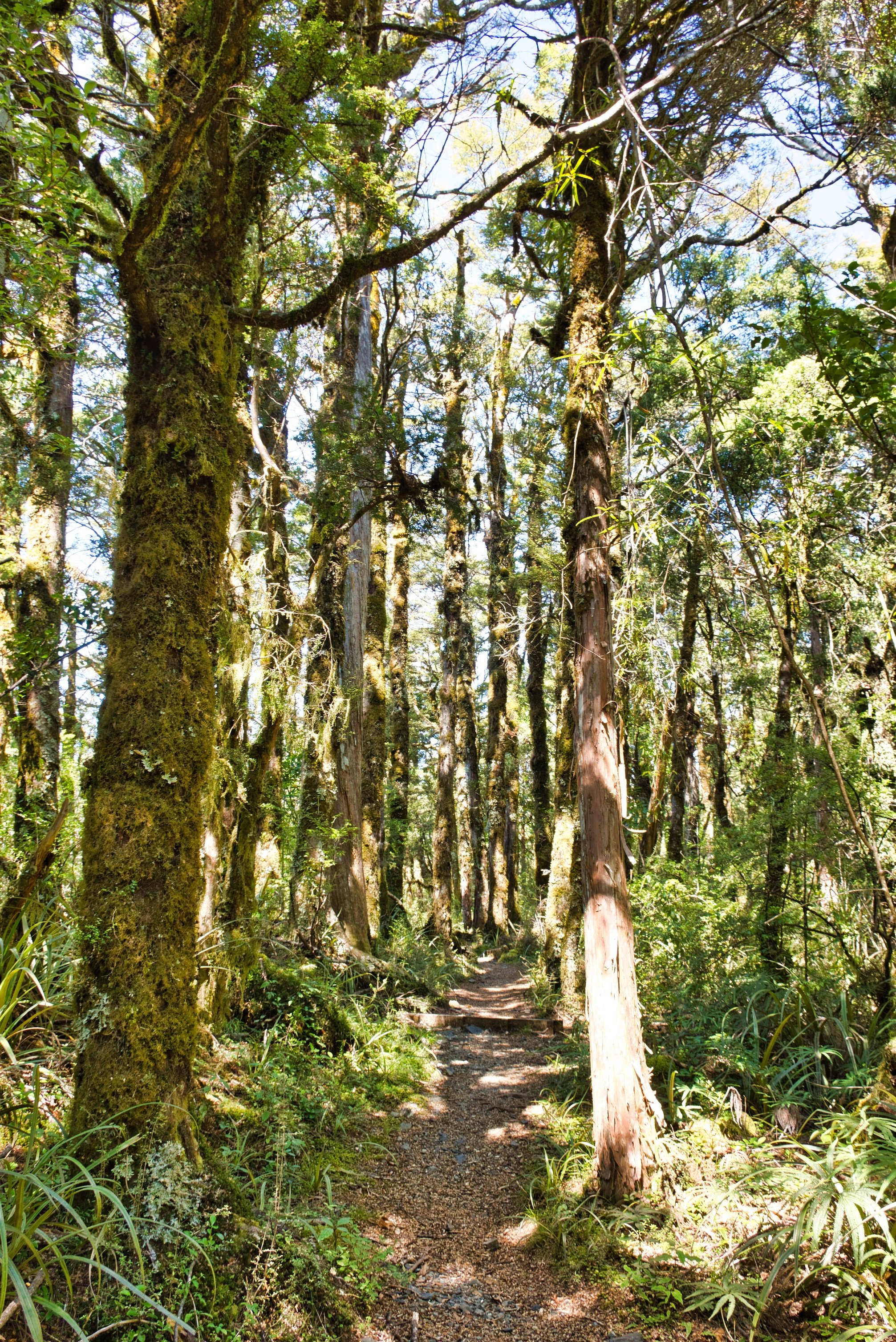
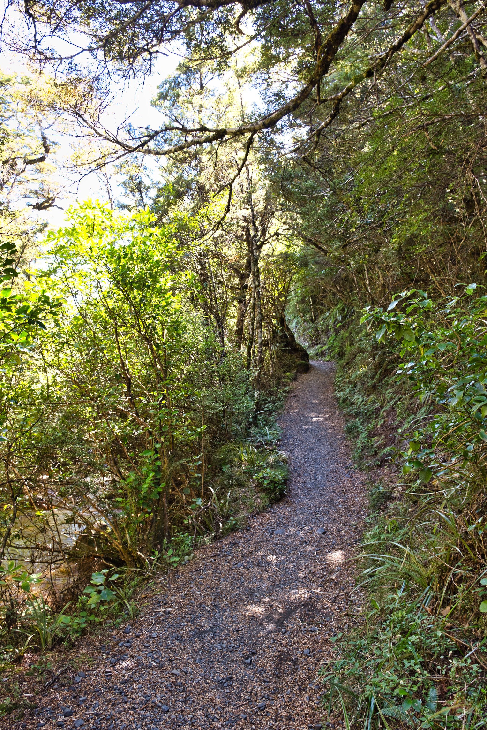
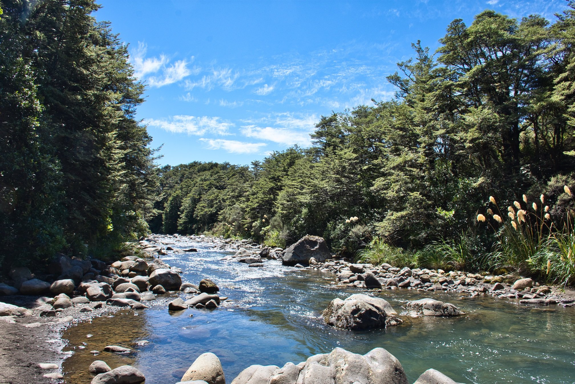
Wet or fine weather the Whakapapanui Walk is a good option. You can start this walk from the same area as the Whakapapa Nature walk or you can end here. It's a two-hour walk, 6km, that can either be completed as a loop coming back to where you started using the highway (it starts/finishes 3km down from the iSite) or you can come back the same way. You will be following the Whakapapanui Stream passing through more Beech forest and alpine wetlands.
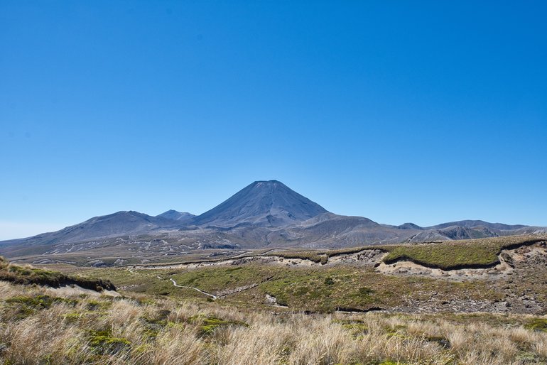
If you walk back on the highway you'll have great views of Mt. Ngauruhoe and Tongariro to keep you company on your walk.
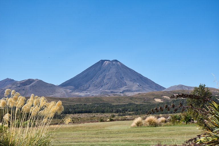
Mt Ngauruhoe from the road
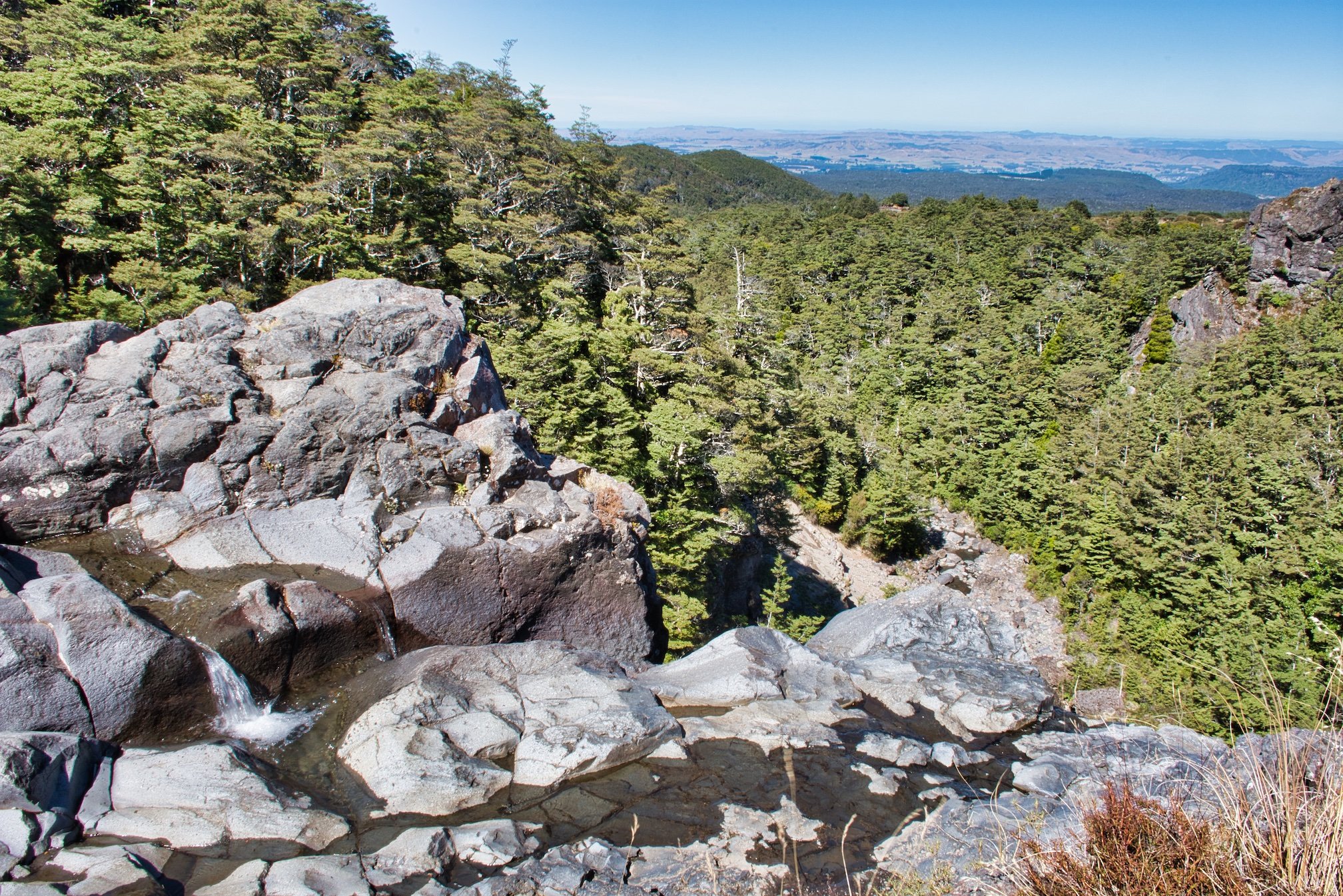
Silica Rapids walk also has two entrances although one is 250m above the Visitor Centre and should take about 2 and half hours return and the other is 2.5km up the Bruce Road where there is a carpark, which cuts 3km off the 7km walk from the Visitor Centre.
The walk from above the iSite is from the same place as the other two above. When you are on the Whakapapanui Walk you come to a T-intersection where you can go right to Silica Rapids or left for a 5-minute walk out.
The track is good to Silica Rapids with a few stairs and steep sections
There is so much to see on this walk including a stretch of water known as Golden Rapids. You can also see this on the Whakapapanui Track but the bush has grown so much that it is easier to see here.

Crossing a small bridge, you can plainly see the iron-rich waters which give Golden Rapids their colour and name.
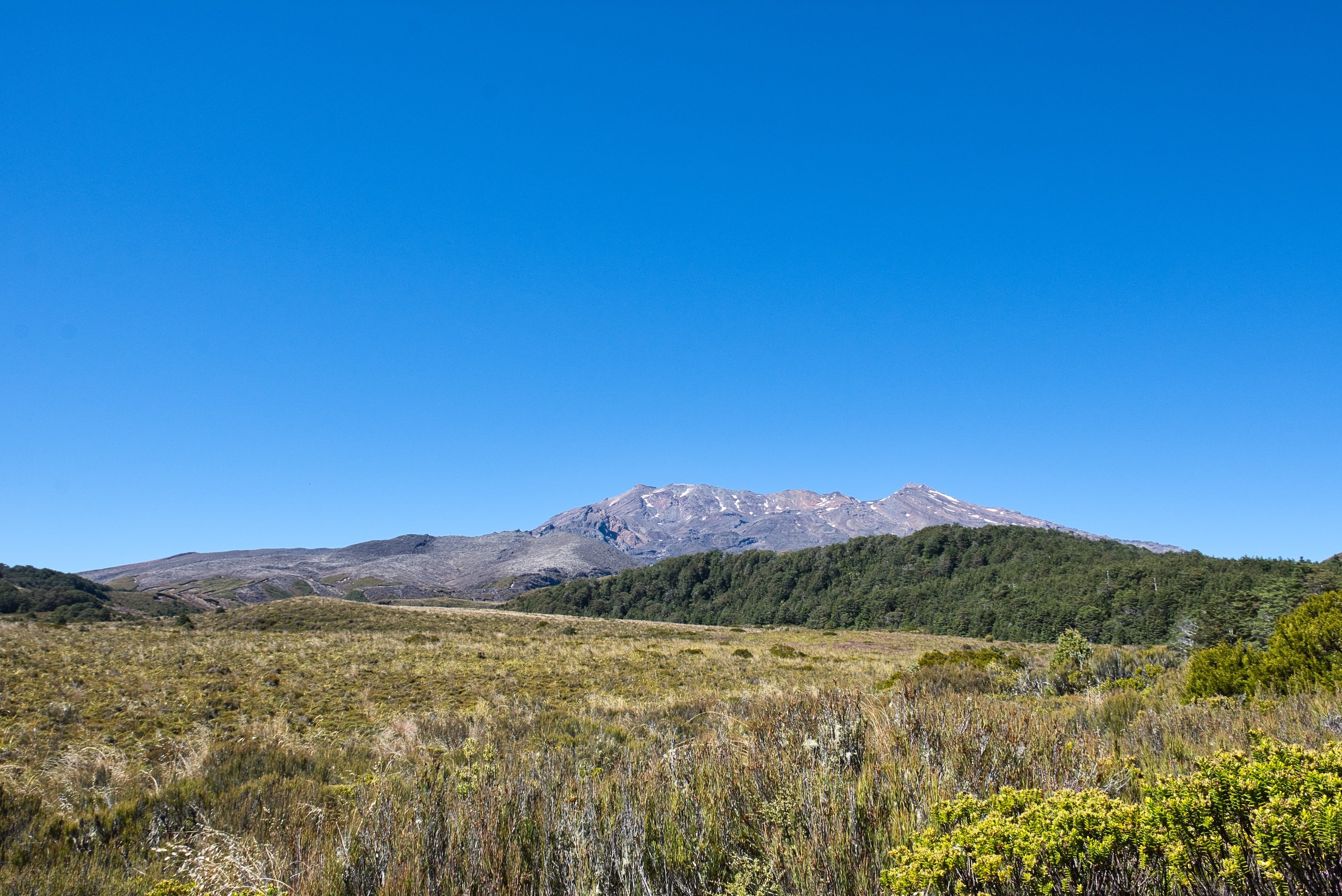
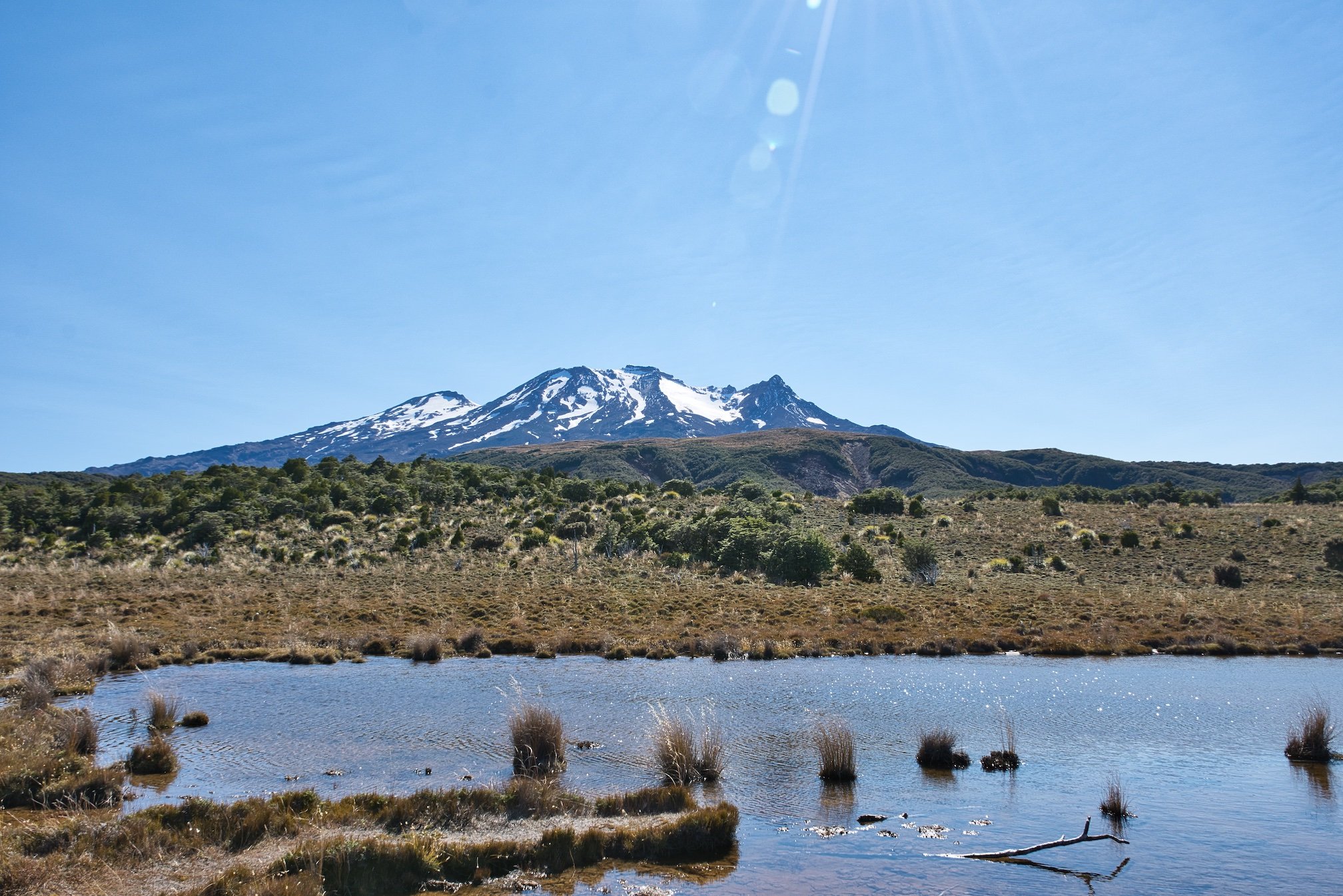
On this walk, you pass through more Beech forest, sub-alpine plants and wetlands up on the Alpine Bog. Going across the bog you use a boardwalk, so make sure you stay it. It is from here that you have a perfect of view of Mt Ruapehu.
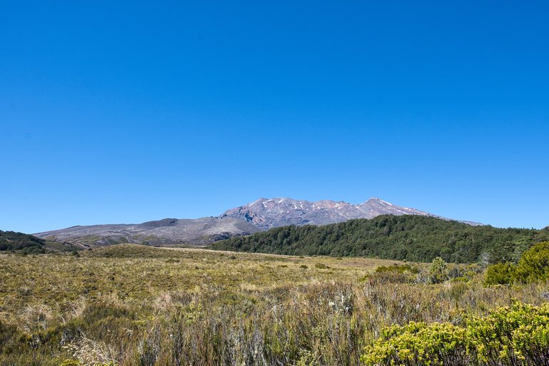
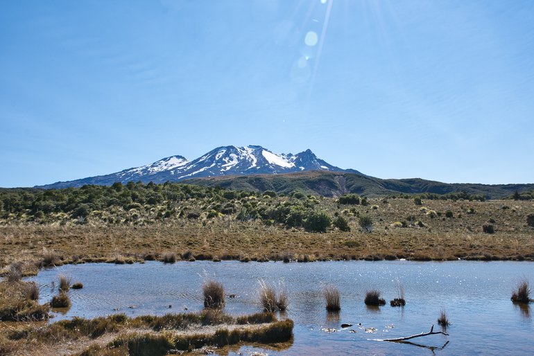
Mt. Ruapehu under blue skies
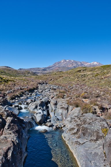
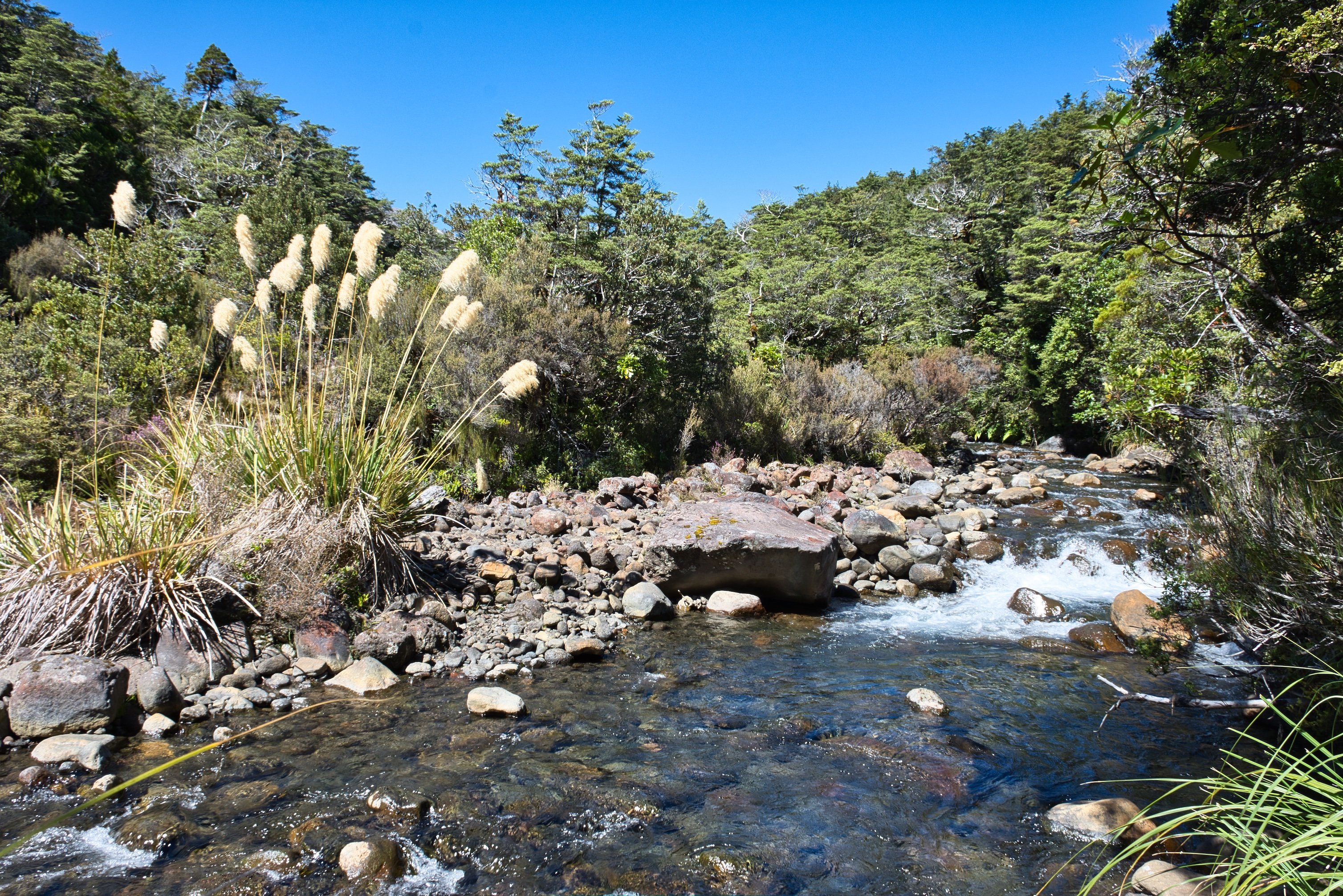
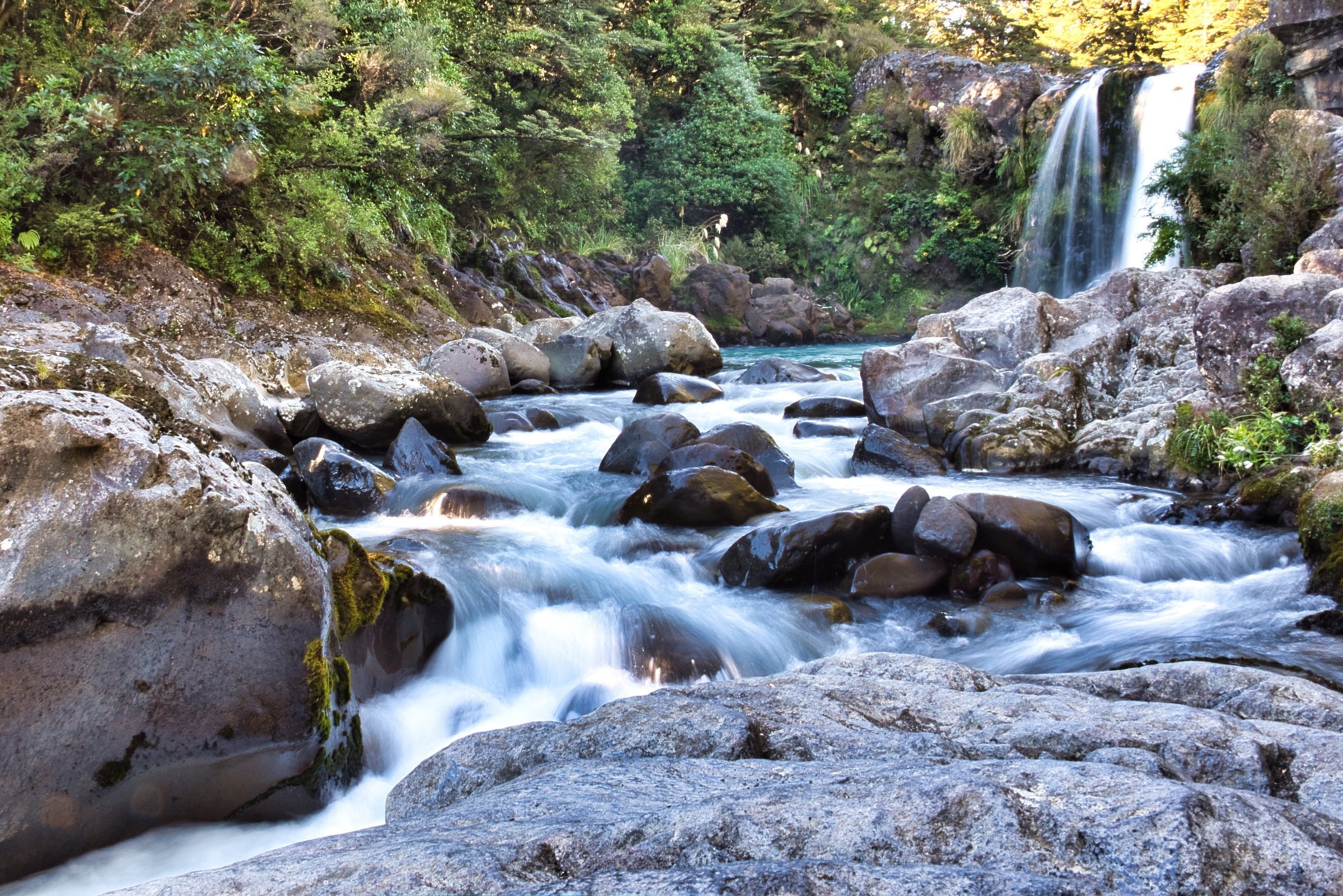
You also cross over the Waikare stream via a bridge and it's after here that you a great view of the stream cascading down over the rocks.
It's still about another half-hour from here and you haven't stopped seeing the sights on this walk either.
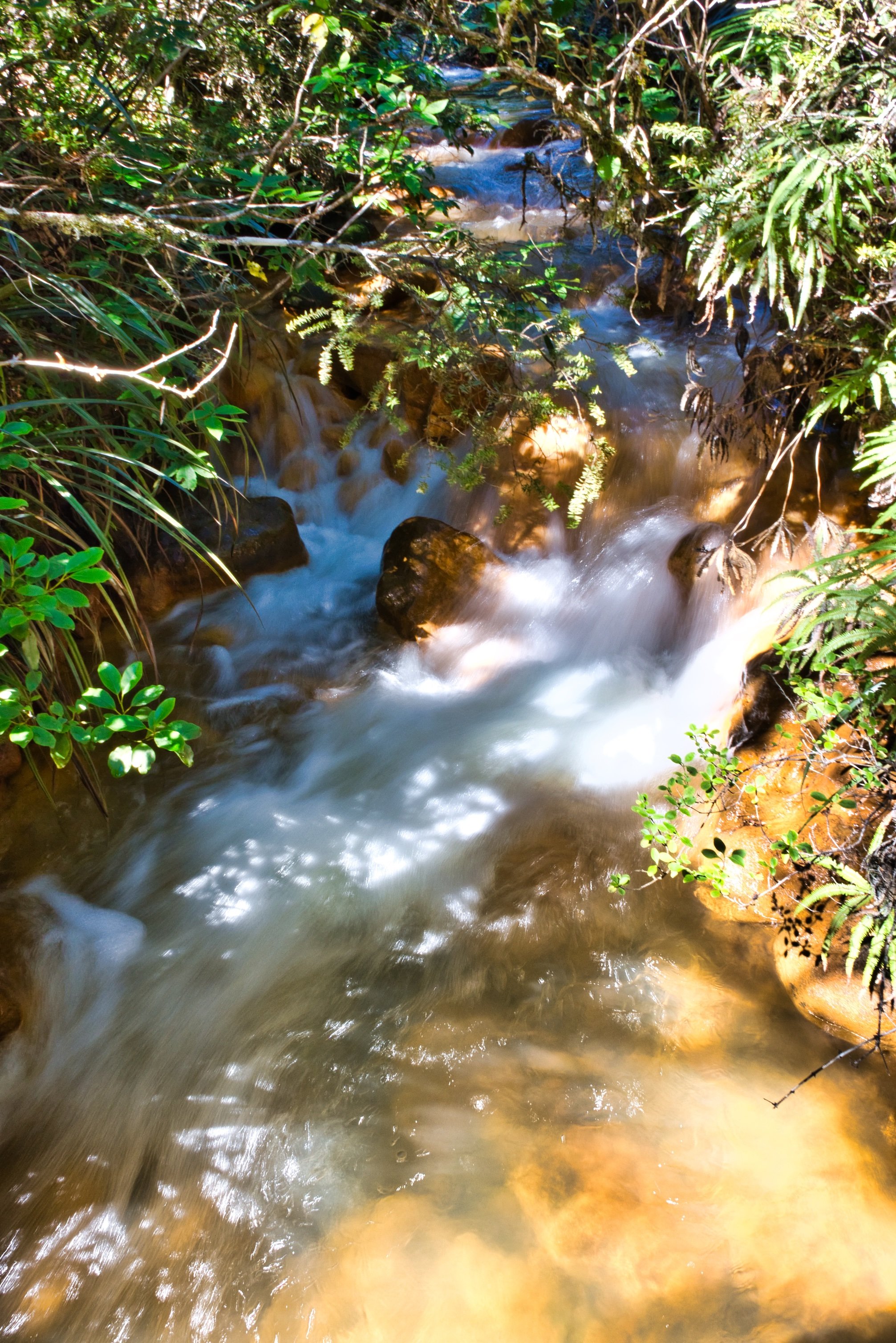
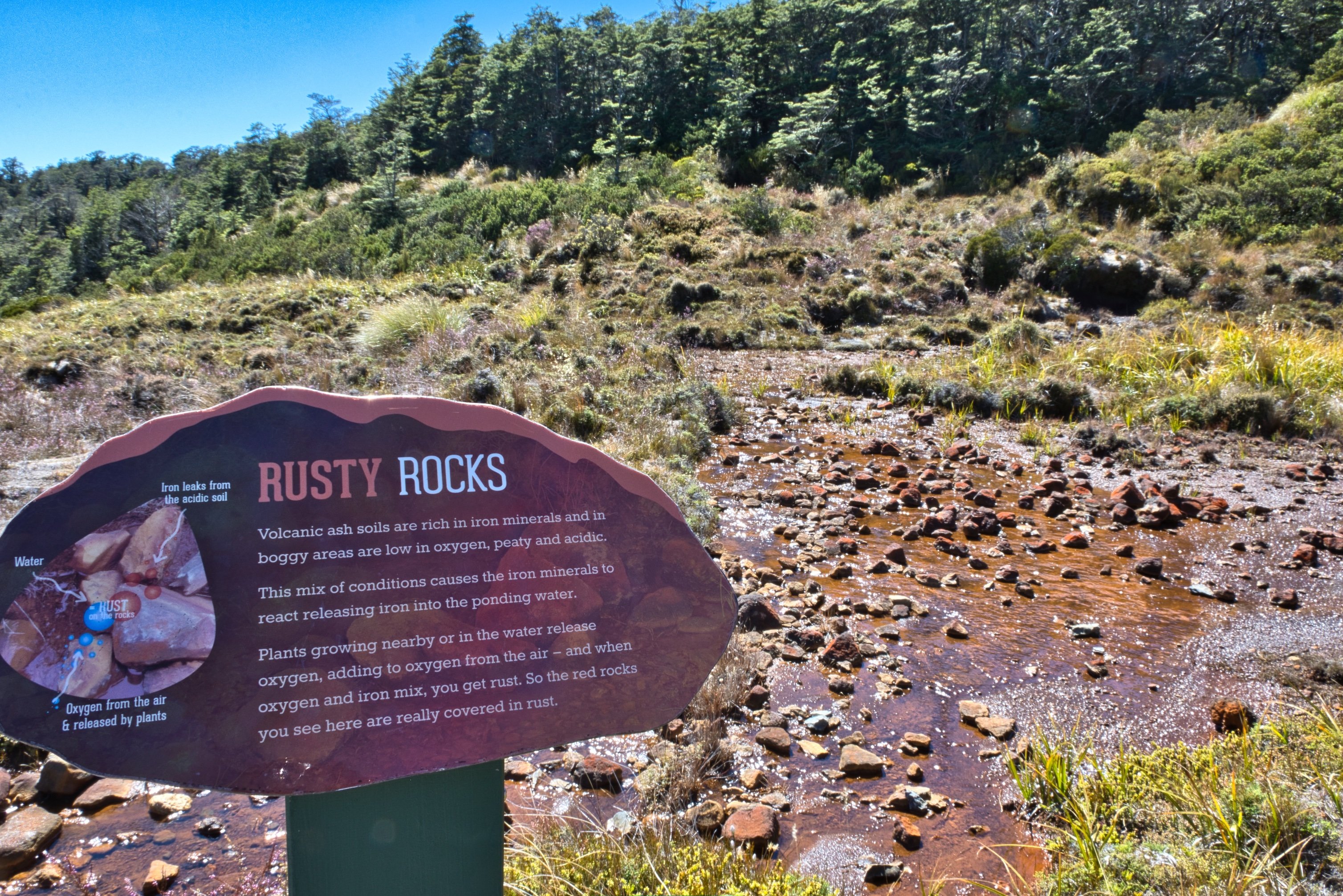
The next natural point of interest is the Rusty Rocks. Back on a boardwalk, you can really see the rust on rocks caused by the iron in the water and oxygen in the air. It really is amazing.

With information along the track you really get an education along the way
Only another few minutes from the lookout, you start to see the yellow mineral-laden waters cascading down and then the terraces of Silica Rapids. From here you have a lookout over the terraced waters.
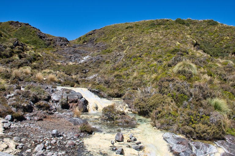
The yellow waters cascading down
From here you can go up onto the Bruce road which is only 45-minutes away and walk down the road or go back the way you came which is what I did.
The other two walks are 4-5kms back down the road from the Visitor Centre and are both good family walks.
The Mounds Walk is 20-minutes return and it is here you have great views of Mt. Ruapehu and the surrounding area. It's 5km back down the road and well signposted on the left-hand side. The mounds refer to giant mounds of volcanic debris and you can walk up to the lookout on one of the mounds for great 360° views.
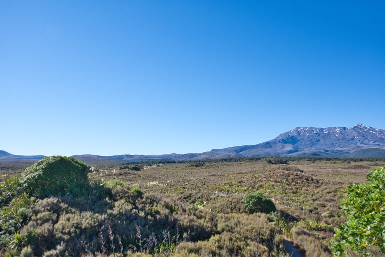
The view from the lookout looking over the mounds and Mt. Ruapehu
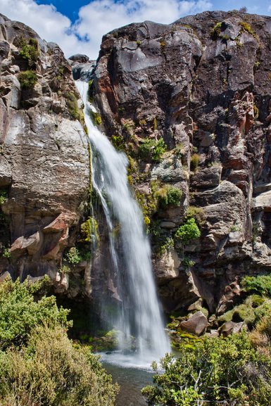
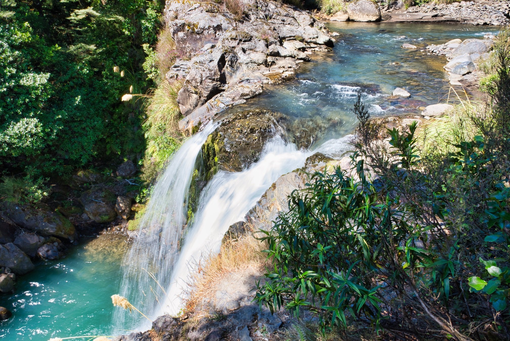
Tawhai Falls Walk is also 20-minutes return and another great one for the kids. 4km back down the road from the Village, it is again well signposted but on the right-hand side of the road, although you can also park on the left-hand side. One of the best waterfalls with a 13m drop, it is also the location of Gollum’s pool from Lord of the Rings.
You first come to a lookout at the top of the falls which shows the colour of the surroundings and water.

The first lookout is at the top of the falls
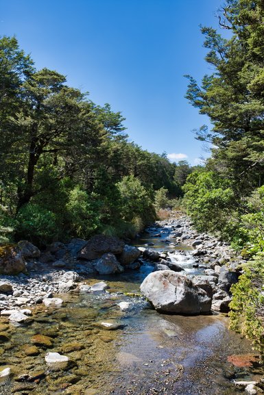
The track is good but once you get to the river, it's stairs and rocks which most including myself found challenging.
The rocks down at the end of the track to the view of the waterfall
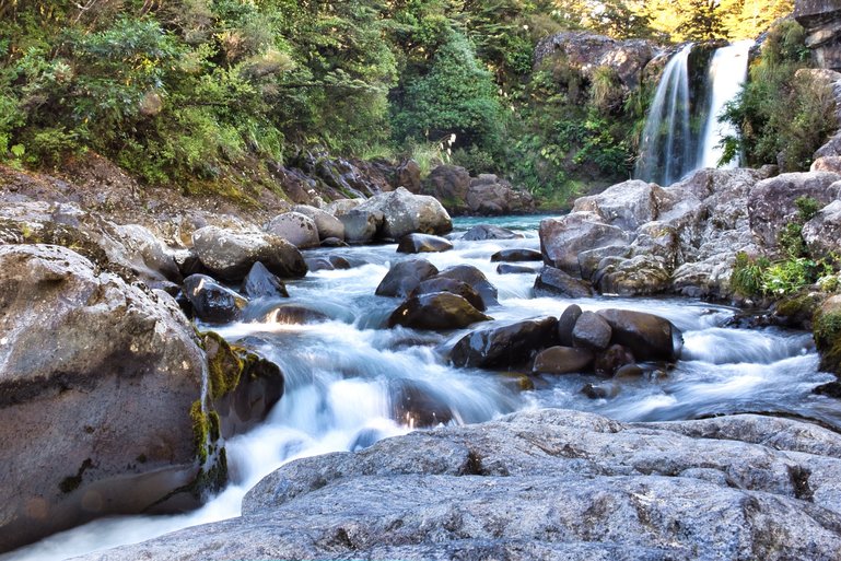
The beautiful Tawhai Falls and cascading waters of Whakapapanui River
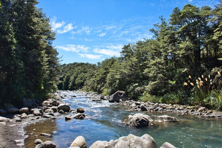
The Whakapapanui river down from the falls
Taranaki Falls has an impressive drop of 20m. A two-hour loop walk it has two entrances, both on Ngauruhoe Terrace behind the Chateau Tongariro. The first on the left-hand side is the Lower Falls Track. This has steps and a rougher track but also has glimpses of Mt. Ruapehu before heading into the beech forest and walking next to the stream in parts.
The Wairere stream down from the Taranaki Falls
Once you get to the falls you have great views of the waterfall and you can go swimming in the pool. If you head along the track further there are steps which are steep but head to the Upper track.
The beautiful Taranaki Falls falling into the pool below that you can swim in
At the top of this track, you can continue back or take the track to Tama Lakes which is another hour and a half away. Remember if you go onto Tama Lakes from here it will be another 3-4 hours before you get back to Whakapapa Village.
Heading back to Whakapapa Village, the track is much easier. First, you can see the Wairere stream going down to the falls before the track leads you past old lava flows and magnificent views of Mt. Ruapehu.
Crossing the bridge you have great views of the water going down to the falls and Mt. Ruapehu. The water is so clear although it's hard to tell in the photo
It takes less an hour to get back to Whakapapa Village with only about 5-minutes in the bush.
Tama Lakes is one of the longer day walks at 5-6 hours. You can do this track after seeing Taranaki Falls as it is an extension of the Upper falls track starting at the top of the falls.

The easy upper track to Taranaki Falls and Tama Lakes
Once you have reached the top of Taranaki Falls, it's still an hour-and-a-half walk to the Lower Lake and it's all uphill (and stairs) for the next 20-minutes.

The longest steep part of this track is from the top of Taranaki Falls
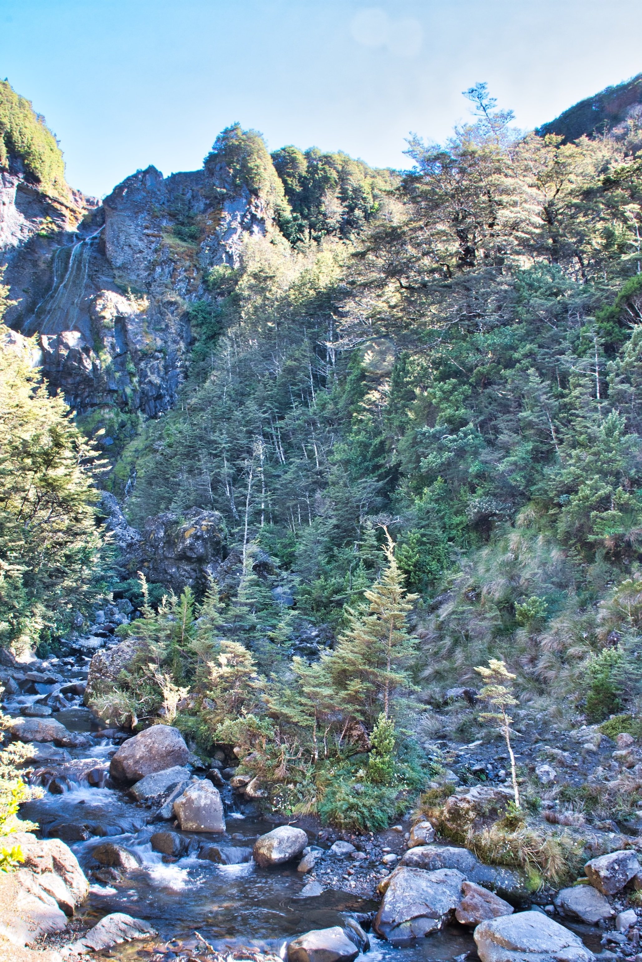
Along the way, you pass over small streams that you can jump or negotiate with a couple of steps but there is a wet water crossing and you should check with iSite if there is any or much water here.
I did the walk in Autumn and it had been a dry summer so I got t dry river crossing
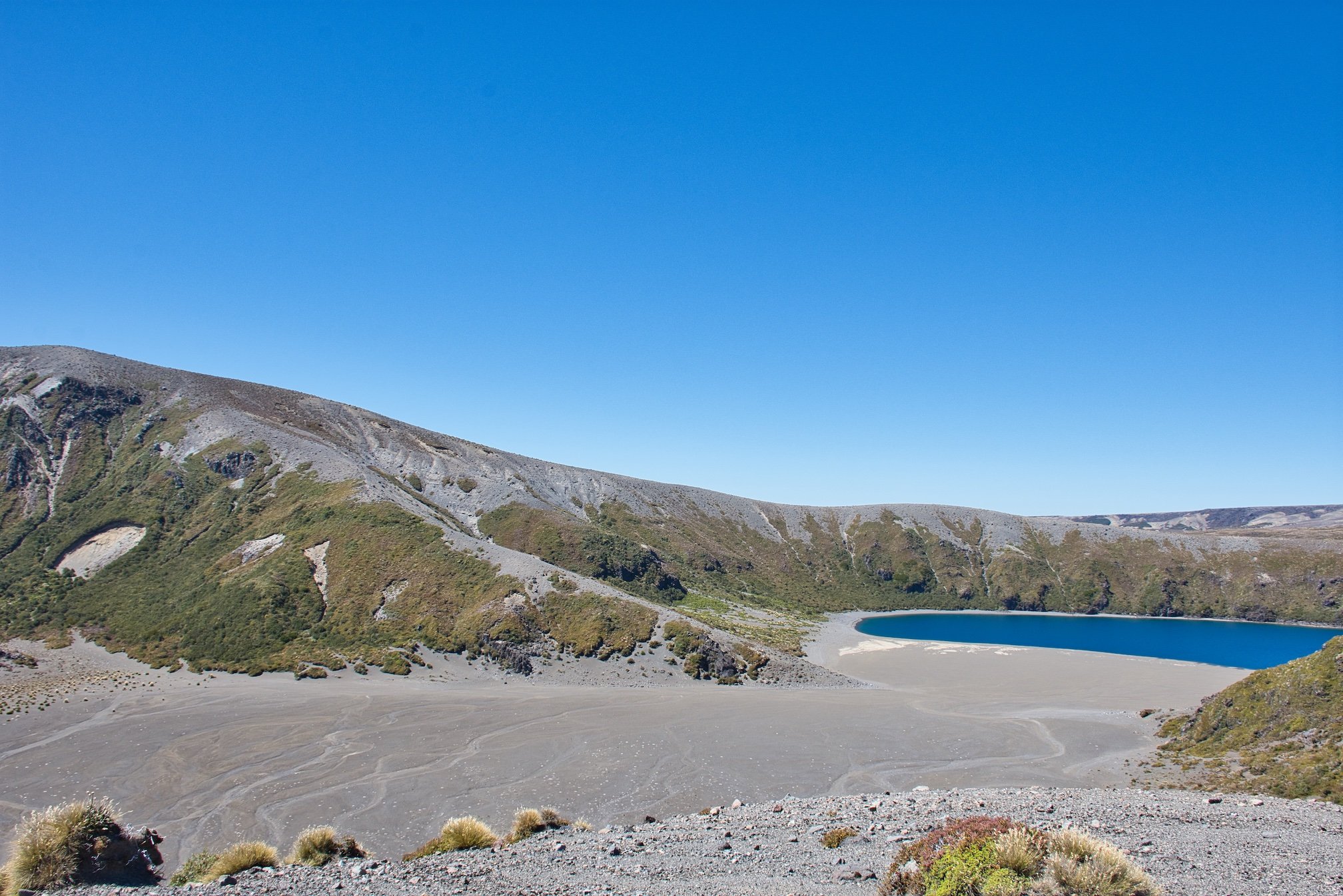
You come across the lower lake and it's a surprise after all the walking along a track to come out onto a large area that looks down on the lake. This is also a good spot to have something to eat.
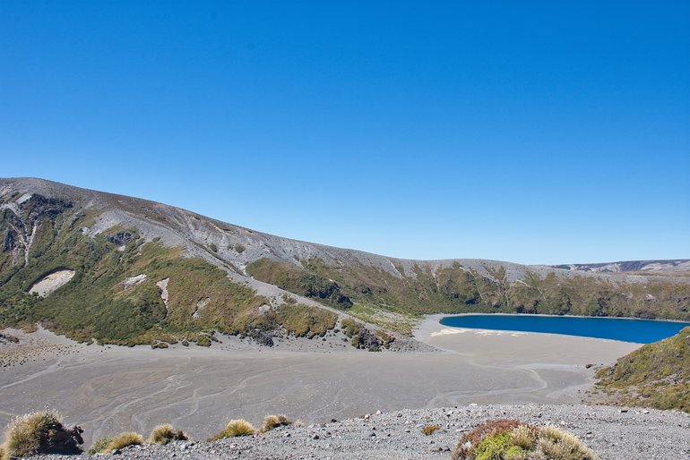
The very blue lake of Lower Tama Lake
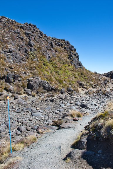
I didn't go up to Upper Tama Lake. The climb up isn't a track and you follow the poles up to the ridge. There are no tracks down to the lakes and descent is very steep. As you are also in the saddle the wind goes through strongly if there is a westerly and you should be prepared with the required clothing.
Tama Lakes track with Mt Ngauruhoe and the ridge you walk up to Upper Tama Lakes on the right
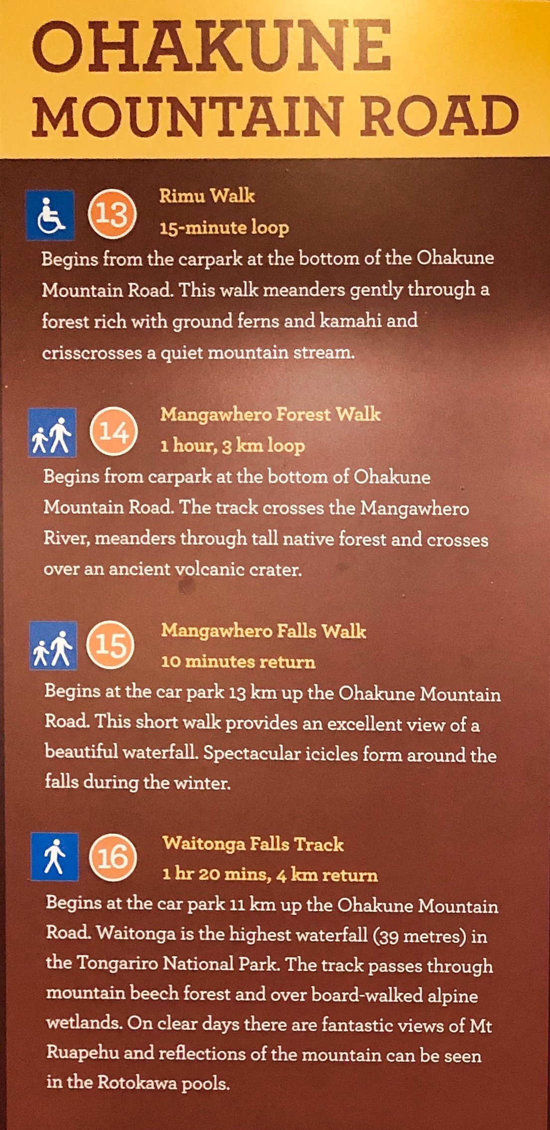
There are also walks off the Mountain Road in Okakune.
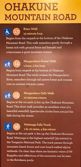
The walks in the Ohakune area on Ohakune Mountain Road
The Rimu Walk is a 15-minute loop walk that’s good for wheelchairs and strollers. Beginning from the carpark at the bottom of the Okakune Mountain Road, this walk follows the stream in a forest filled with Ferns and Kamahi.

Information plaques on the plant life in the area are along the track and large Rimu are standing tall breaking through the top of the canopy
The Mangawhero Forest walk is longer at an hour but similar to the Rimu walk and starts at the same place. This is a good walk following the Mangawhero River and passing through bush and tall Rimu.
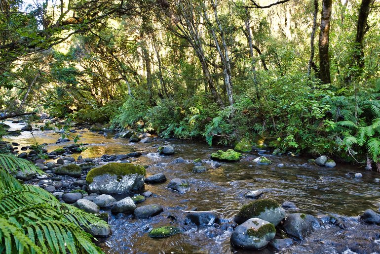
Coming back down to the Mangawhero River just before the end of the track
The track ends on the road down to the Mangawhero campground and you can either go back the way you came or return along the Ohakune Mountain Road.
Thirteen kilometres up the mountain road is the short 10-minute walk to Mangawhero Falls.
I was doing all these walks in March (Autumn in New Zealand) and the water was nearly non-existent.
There are two lookouts, one on top of the falls and another a couple of minutes further down that gives you a look back at the fall of the water. As there was so little water I took a photo of it but you can really see (or see the lack of) how much water there was.
The little trickle of water that is Mangawhero Falls. You really need to look at to see the water. (It's in the middle of the shot)
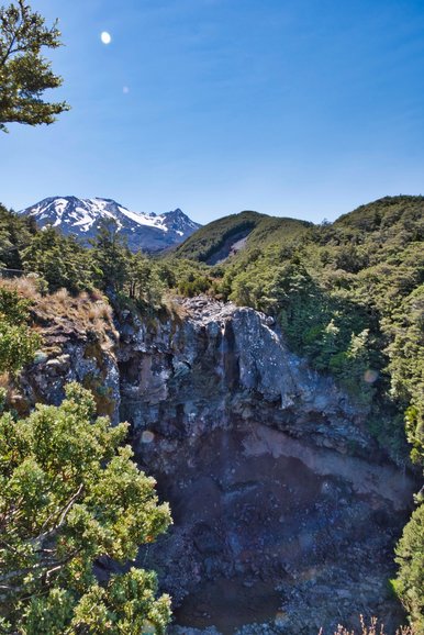
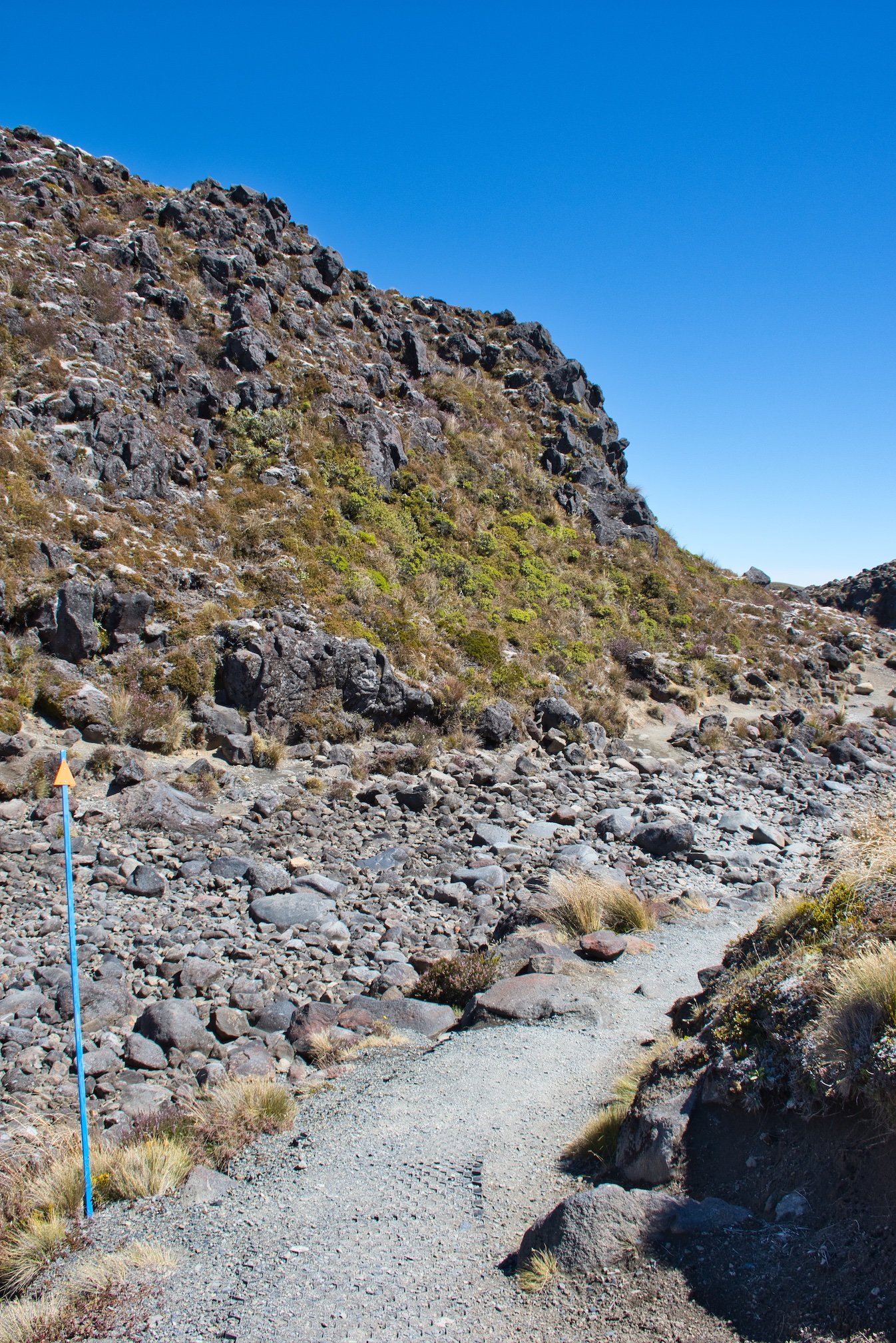
Only 11kms up the road is the Waitonga Falls track. At 1 hour 20minutes, it leads to the highest waterfall at 39m in the National Park. Once again you have beech forests and alpine wetlands that are passed over by boardwalks. You also have great views of the mountains on clear days.
You come out of the bush to a boardwalk and a fantastic view of Mt Ruapehu
From here it's back into the forest and downhill and stairs until you reach the lookout for Waitonga Falls.

The nearly non-existent falls in the top left-hand corner
If you wanted to see the falls better you would have to cross the river and go to the other side.
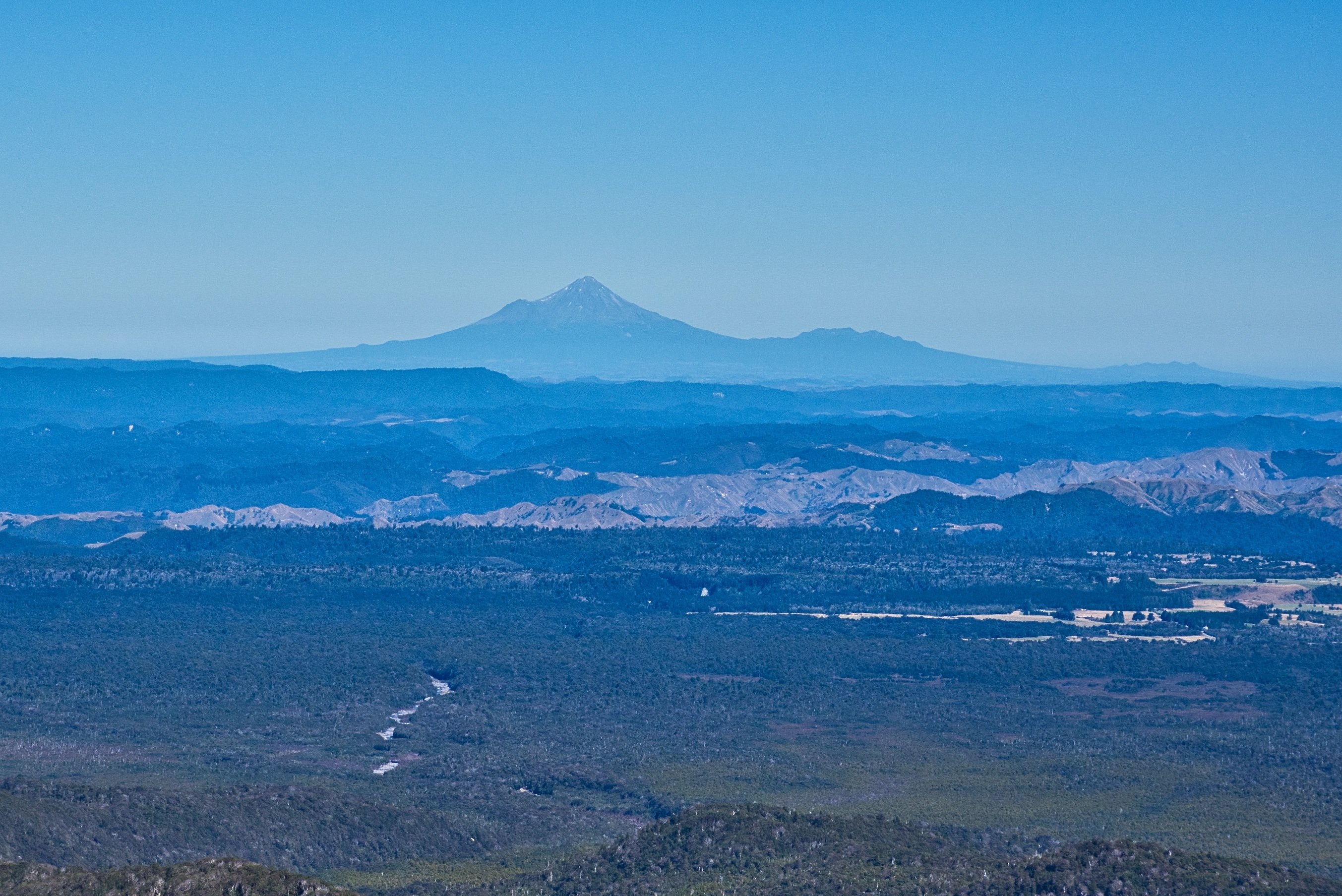
At the top of the road is the Turoa ski-field. 1600m above sea level is the ski-field car park. Out of the ski season, this place is like a ghost town but there are great views especially across to Mt. Taranaki which is on the west coast a couple of hundred kilometres away.
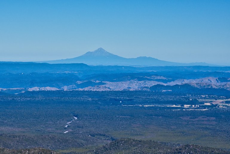
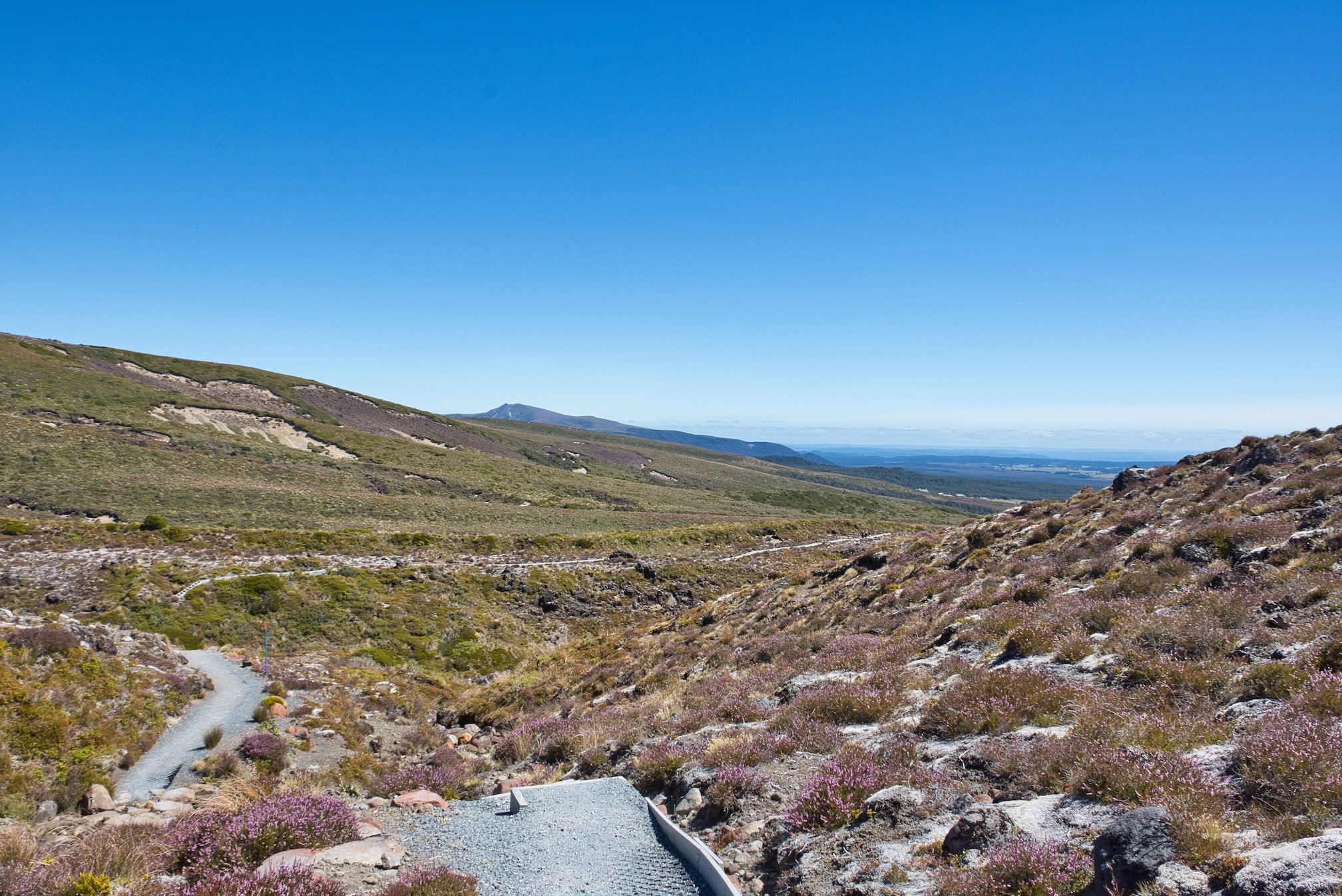
Mt Taranaki on the horizon about 150-200kms away
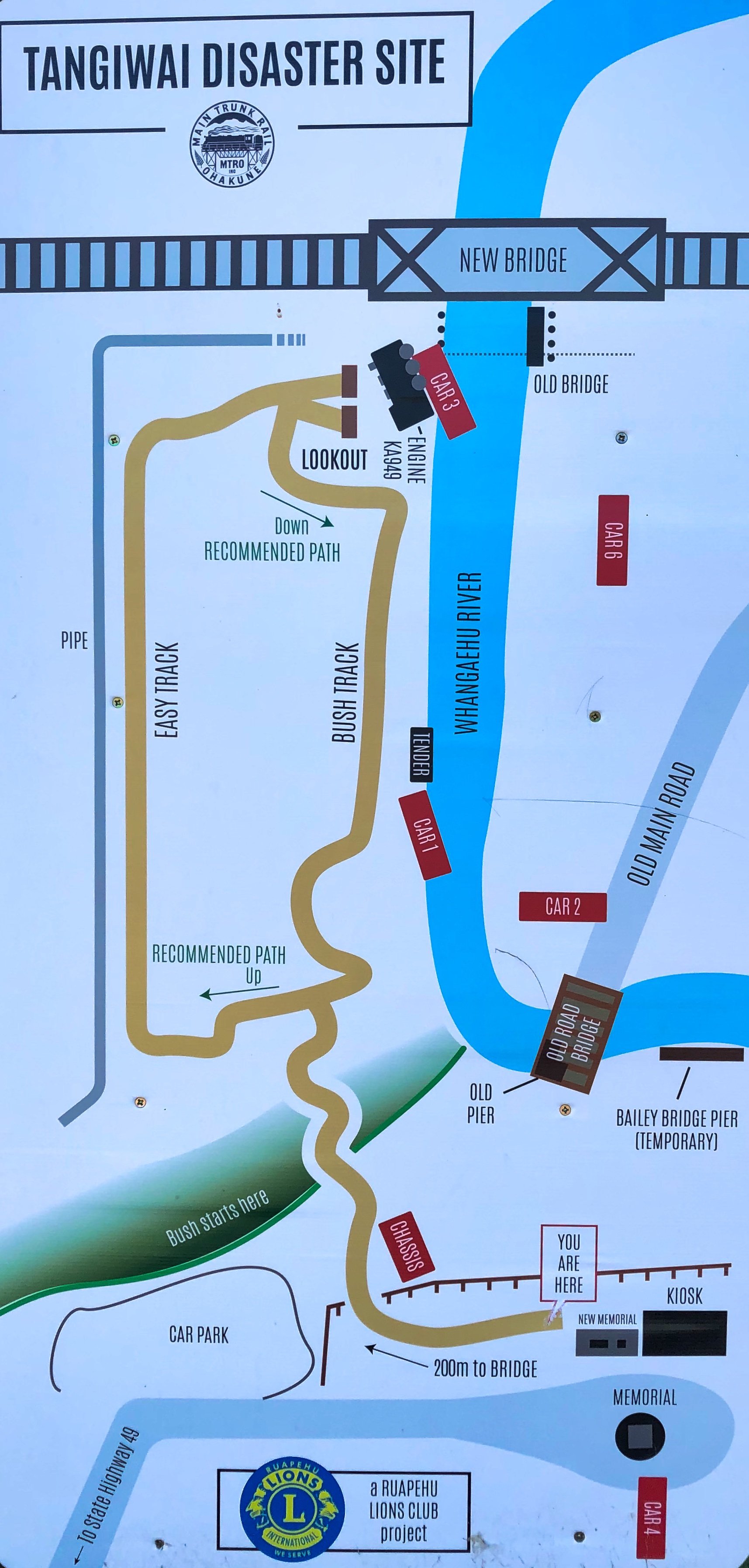
Tangiwai Train Disaster is a rest area between Ohakune and Waiouru is home to New Zealand's worst train disaster.
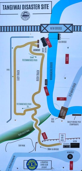
Taigiwai Disaster information site map
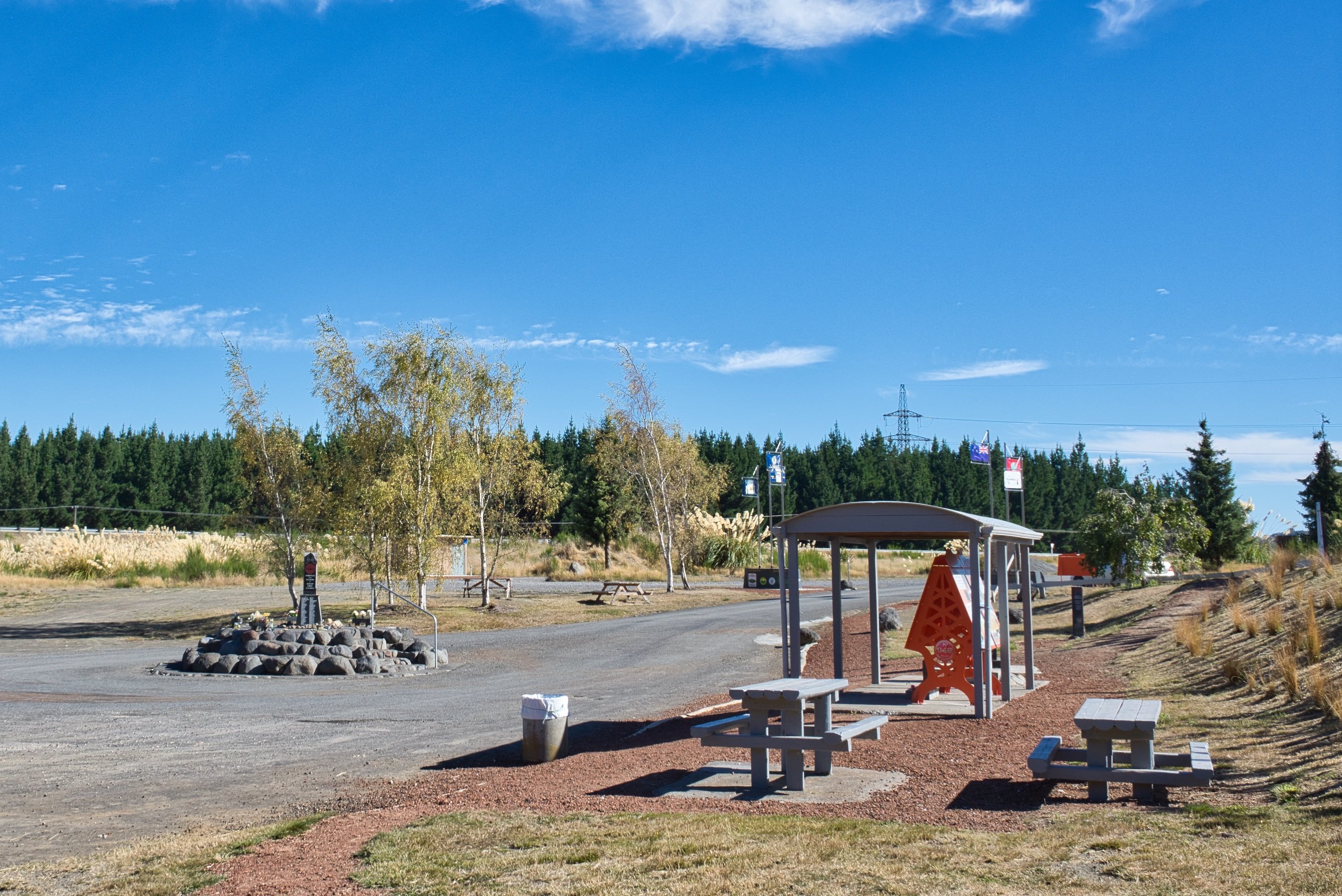
This rest stop has information on the train disaster that occurred on Christmas Eve 1953 as well as picnic tables.

The rest stop with information posts under the shelter
I found it a very eerie site, whether it was my imagination or because I was the only there for about five minutes, it is certainly a place to visit to learn about New Zealand's worse train disaster.
The Whangaehu River was to deliver the lahar from Mt Ruapehu's crater lake which caused this devastation after the rail bridge was weakened from the deluge.
At 10.21pm on Christmas Eve, the Wellington to Auckland night train was in the wrong place at the wrong time. 151 people lost their lives that night, when the train toppled into the river, making it the eighth worst train disaster in the world.
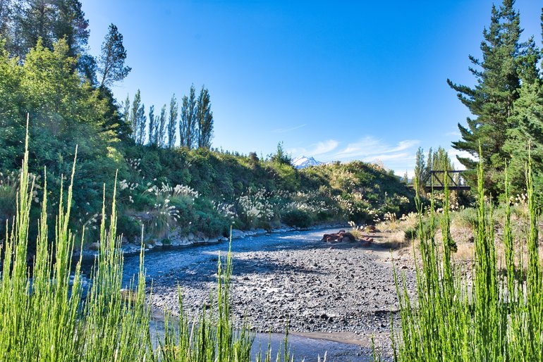
The river with the bridge in the distance that was strewn with train cars
When you're in Waiouru and a great place to visit is the National Army Museum.
This is an area rich in history and walks and deserves more than a one day visit doing one of its walks. There are still many more sights to see than I have listed here.


