Road trips are fantastic, and in the Goldfields region of Western Australia, they're epic. There's no better feeling than discovering free camping sites and significant rest areas to take a break during your drive.
Now that the Covid-19 restrictions have lifted, more and more campers have hit the road, and with fuel prices sky-high, they expect more bang for their buck in other areas like accommodation.
Circumstances do change regularly, so a good app to download is WikiCamps. This app will not only let you know where paid and free camping spots are, but also rest areas, dump points, drinking water, toilets and a whole lot more. The reviews on each site are convenient to help you plan whether you can stay or not.
You will only have to pay a one-off payment of less than AUD$10, and you will save so much hassle on your trip.
Another app that's a must on your road is PetrolSpy. By searching the area you're in or heading to, you can find the cheapest fuel, whether diesel or unleaded. This app is free.
If you plan to make long trips between fuel stops, I highly recommend investing in Jerry cans to carry extra fuel. This is extremely invaluable crossing the Nullarbor, as fuel can be over .80 cents a litre more on this road than just before you hit it, let alone the cities. If travelling east to west, Nundroo is consistently cheaper than anywhere else on this road, and the next stop to find reasonably priced fuel will be Norseman in Western Australia.
Wi-fi can sometimes be a bit hit-and-miss. Due to the remoteness of this state, it is beneficial to have one person with Telstra and another with Optus. This won't guarantee that you will have access to Wi-Fi, but it will increase your chances. There is always Starlink for roaming in the remote outback.
If you have a subscription TV service, download some movies and TV shows so that you have something to watch when you are out of touch. Amazon Prime and Disney+ are two services that you can download onto your device. Netflix can be downloaded as long as it's not an Apple device.
By far, Western Australia is the biggest state in Australia, and the Goldfields take it to a whole new level. From the hot and humid north to the cold and windy south, the hot and dry outback to the bustling metropolitan city of Perth, Western Australia, has it all, and camping is the way to go.
If you want to see all areas at their best, go by the seasons, as it's wet in the north in summer but warm and sunny in the winter. In the southwest, summer is the best time to visit, with warm days and less rain to spoil your visit.
The following are the camping and rest areas I've used on my travels around the Goldfields of Western Australia, and I hope that you find them useful. They are also all pet-friendly.
Goldfields Region, Western Australia
The Goldfields region is the southeastern corner of Western Australia. It encompasses Norseman, Esperance, and Ravensthorpe in the south, as well as Kalgoorlie, Menzies, and Laverton in the north, among other areas.
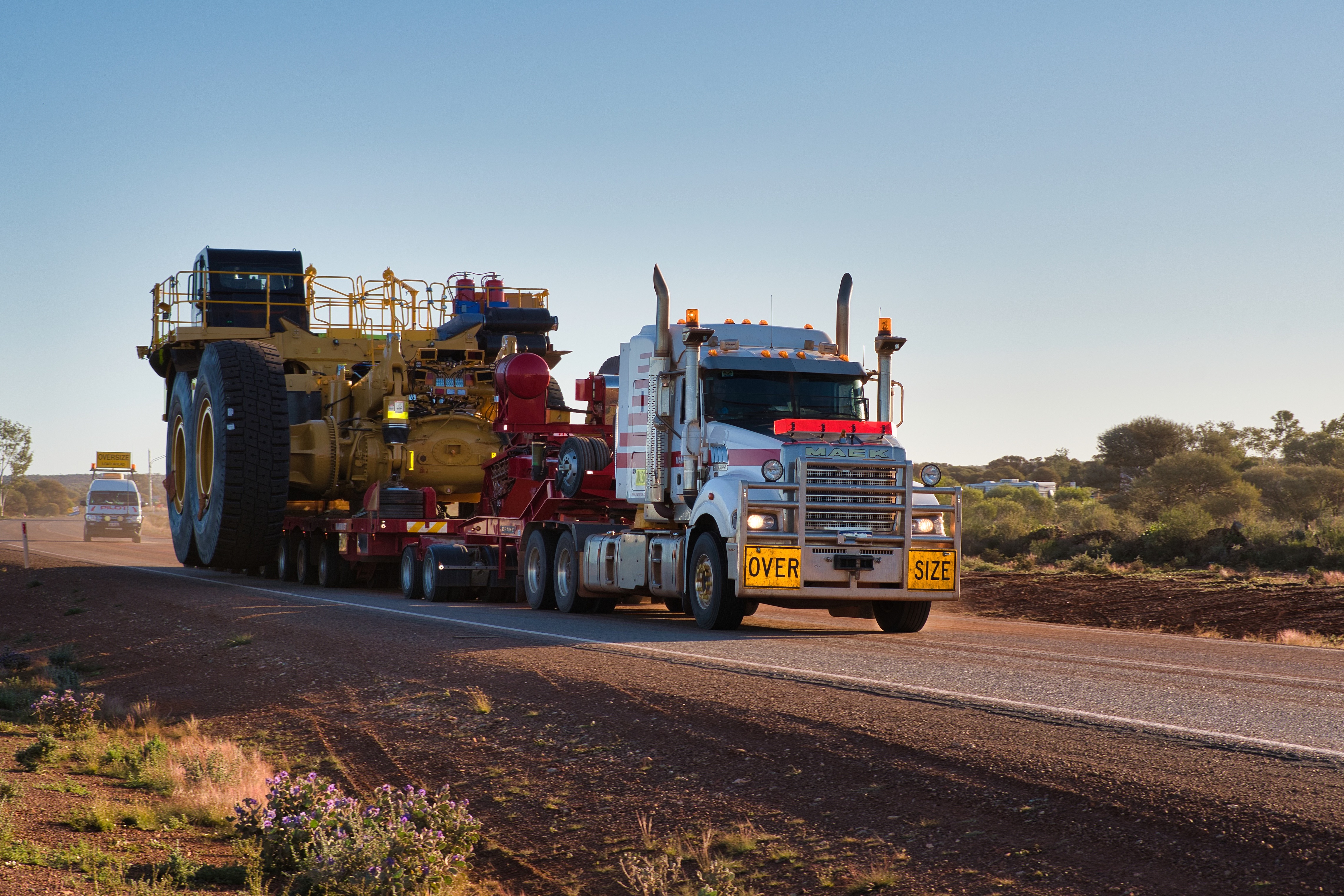
When you're driving in Western Australia, especially the Goldfields, always keep an eye out for oversized trucks carrying mining equipment.
Sometimes, it's best to get off the road, as they take up most of the road.

Watch out when you're on the road with these guys.
Norseman and North of Camping & Rest Areas
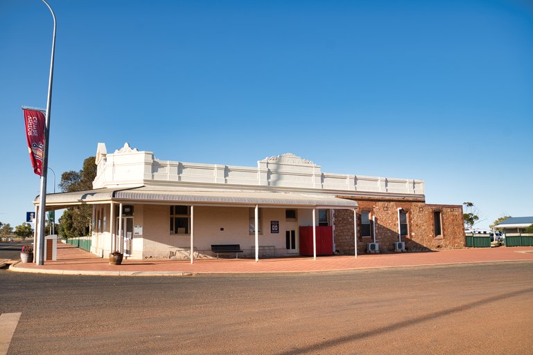
After coming across the Nullarbor, the first bigger town you come to is Norseman, and it's the start of the Goldfields region of Western Australia.
This is the place to refuel if you need to, get supplies from the local IGA, and also the place to decide whether it is north to Kalgoorlie or south to Esperance and, ultimately, the southwest corner.
Mount Thirsty Rest Area, Norseman
Just under 15 km north of Norseman, toward Coolgardie, is a free camp that is not only large but also gives you some privacy.
It's only signposted as a rest area, but it goes a long way back and gives you plenty of room off the road for the night.
As this is just a pull-off, there are no toilets or drinking water here, but it is a great place to spend the night.
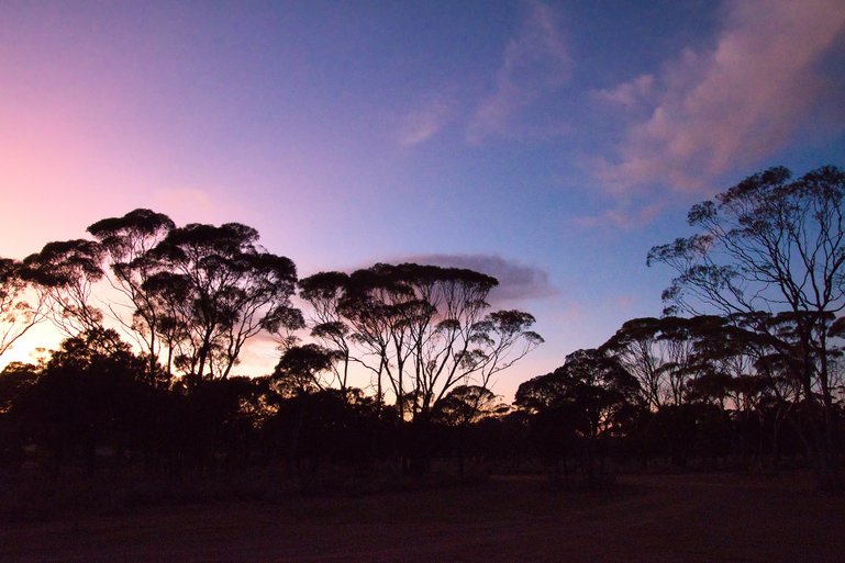
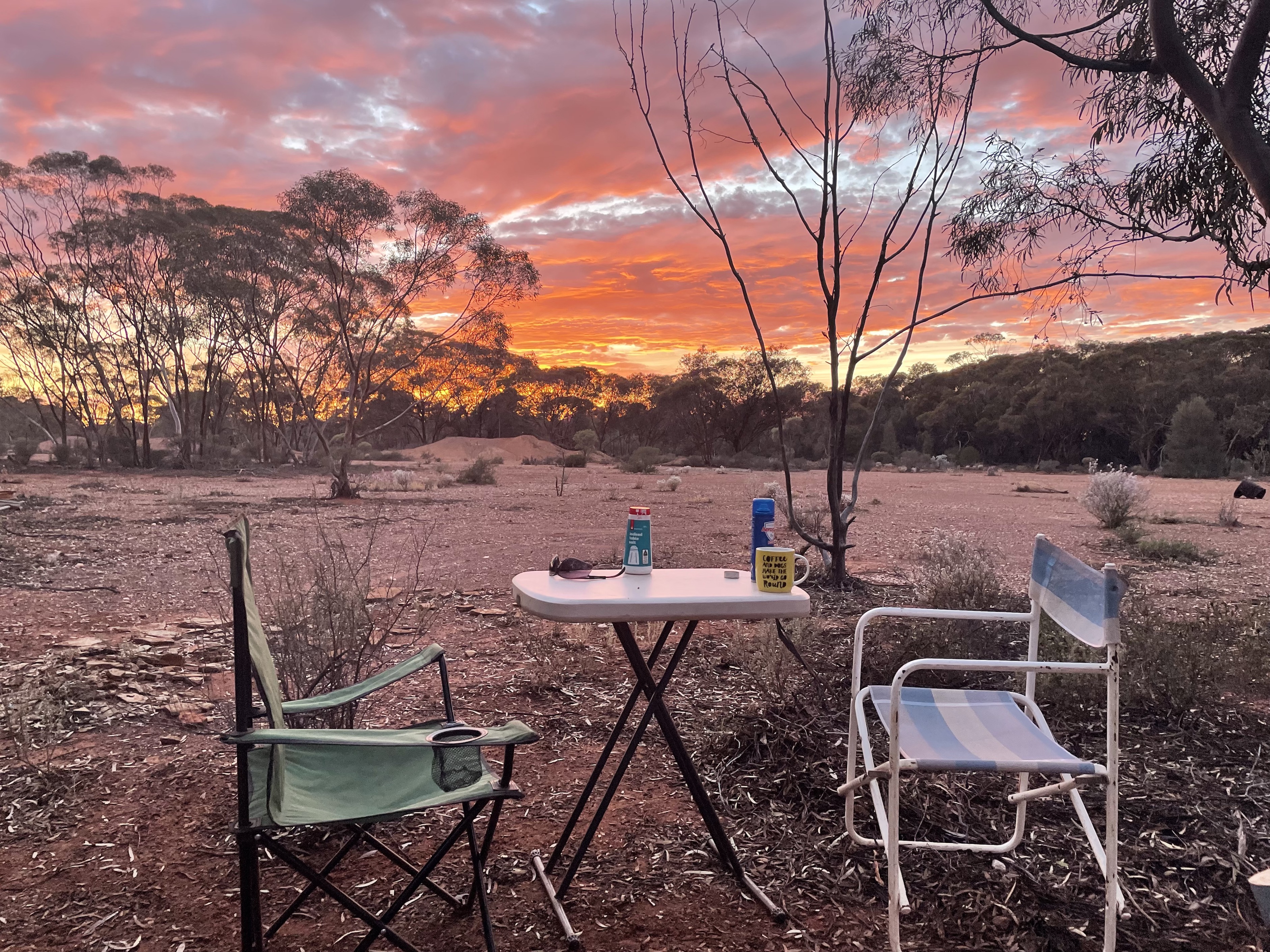
One of the amazing sunsets at Mt. Thirsty.

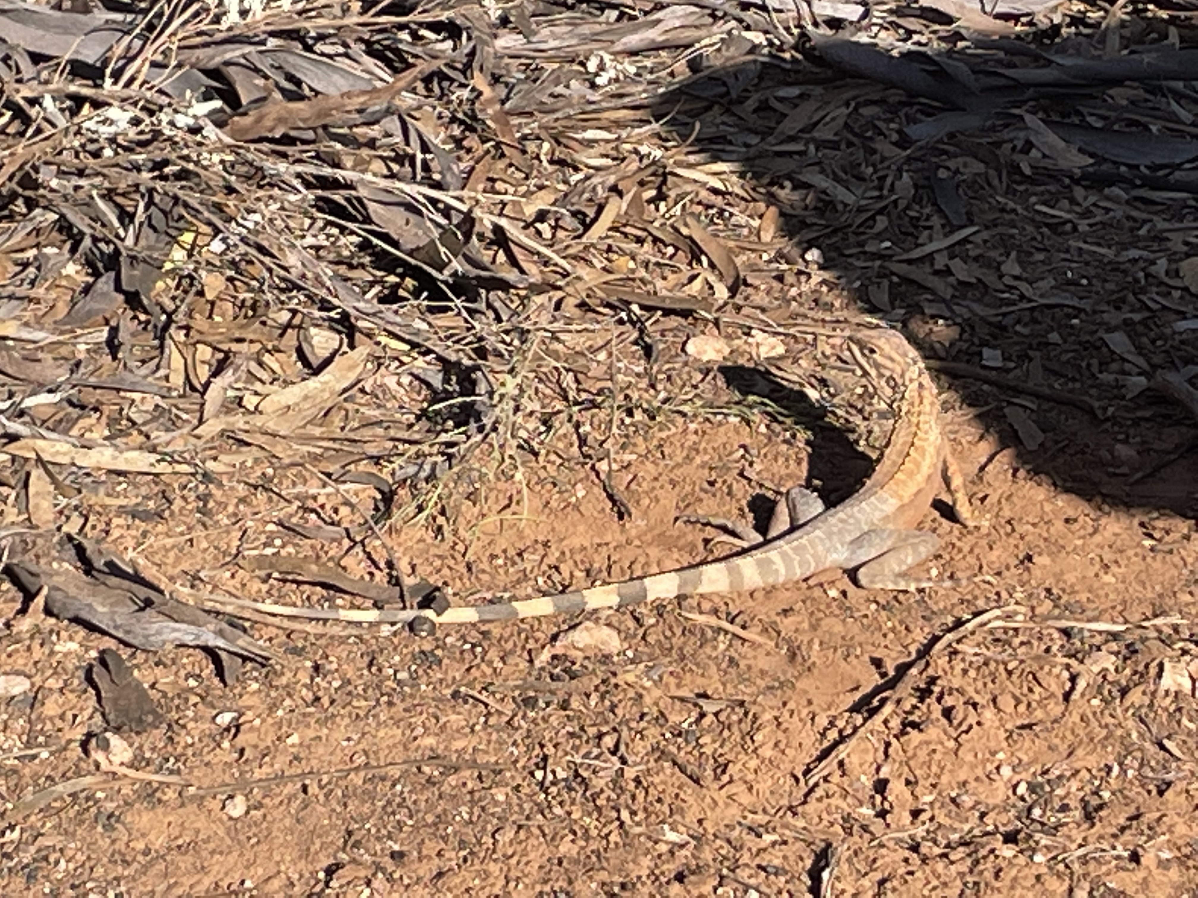
One of the friendly locals is a zebra lizard.
Drinking water and a dump point are back at Norseman at the Welcome Park on Roberts Street. Here are toilets, showers (tokens can be obtained from the Information Centre for hot showers), and a laundromat. There is also an IGA to get any supplies you may need to stock up.
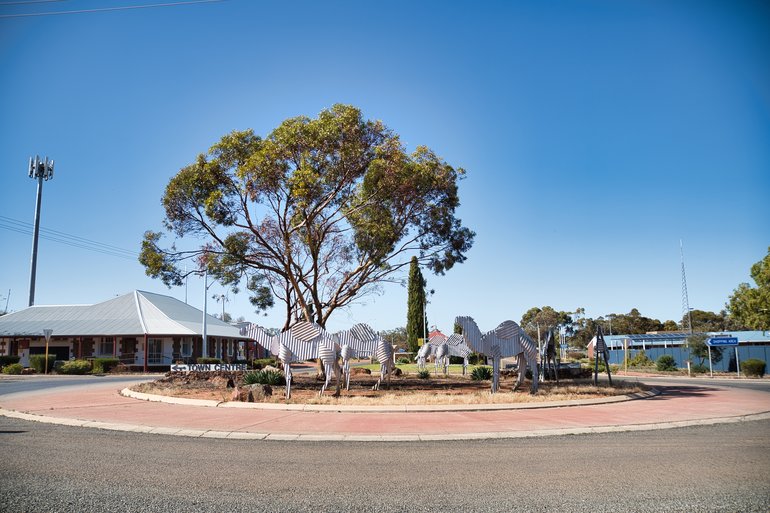
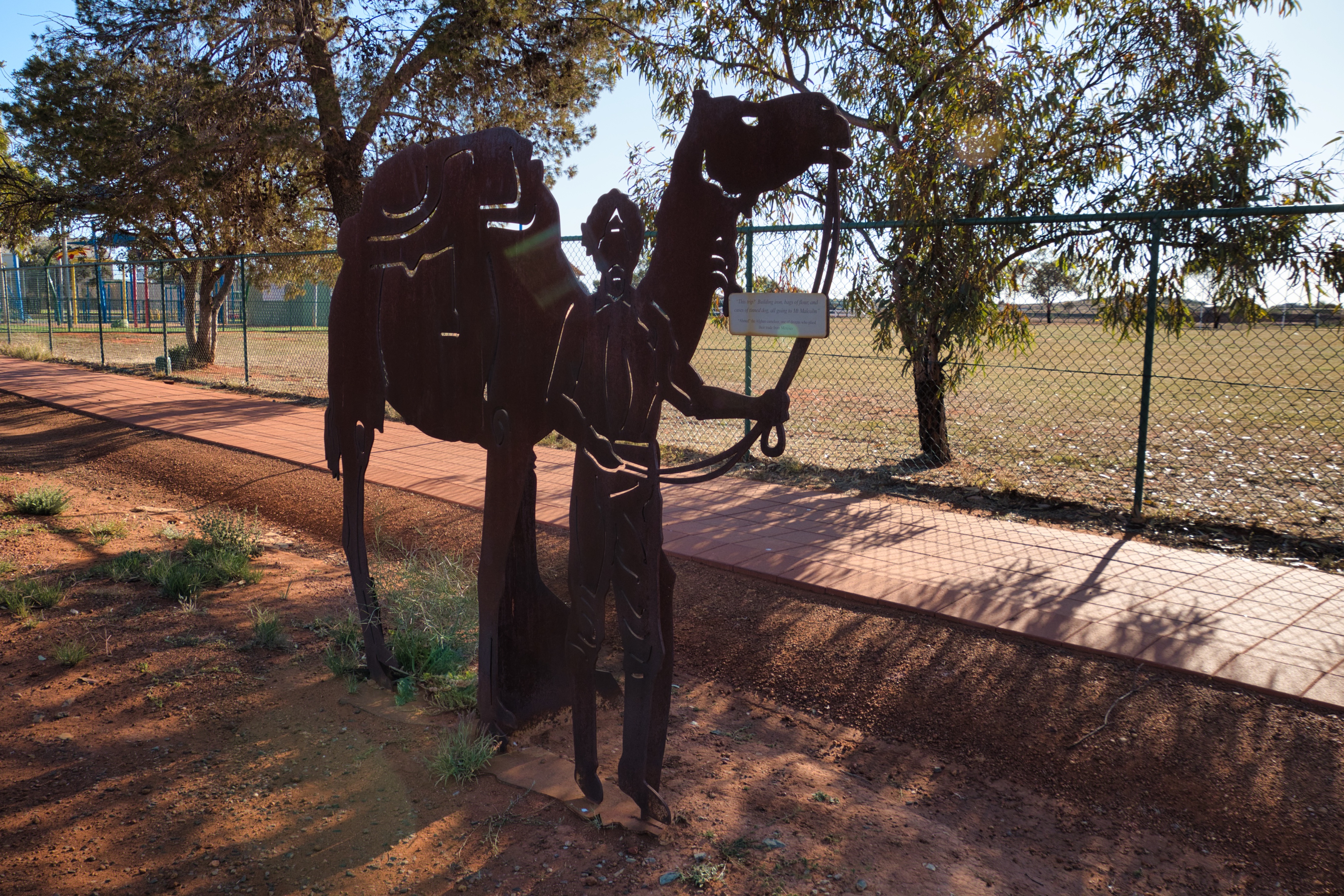
The camels on the roundabout.

Street Art next to the Information Centre.
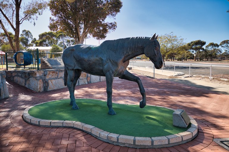
Hardy Norseman, the horse that found a gold nugget in Norseman.
Where It is
Norseman is at the end of the Nullarbor Road linking South Australia and Western Australia.
You'll find the Mount Thirsty Rest Area 15 km north of Kalgoorlie off the Coolgardie/Esperance Highway.
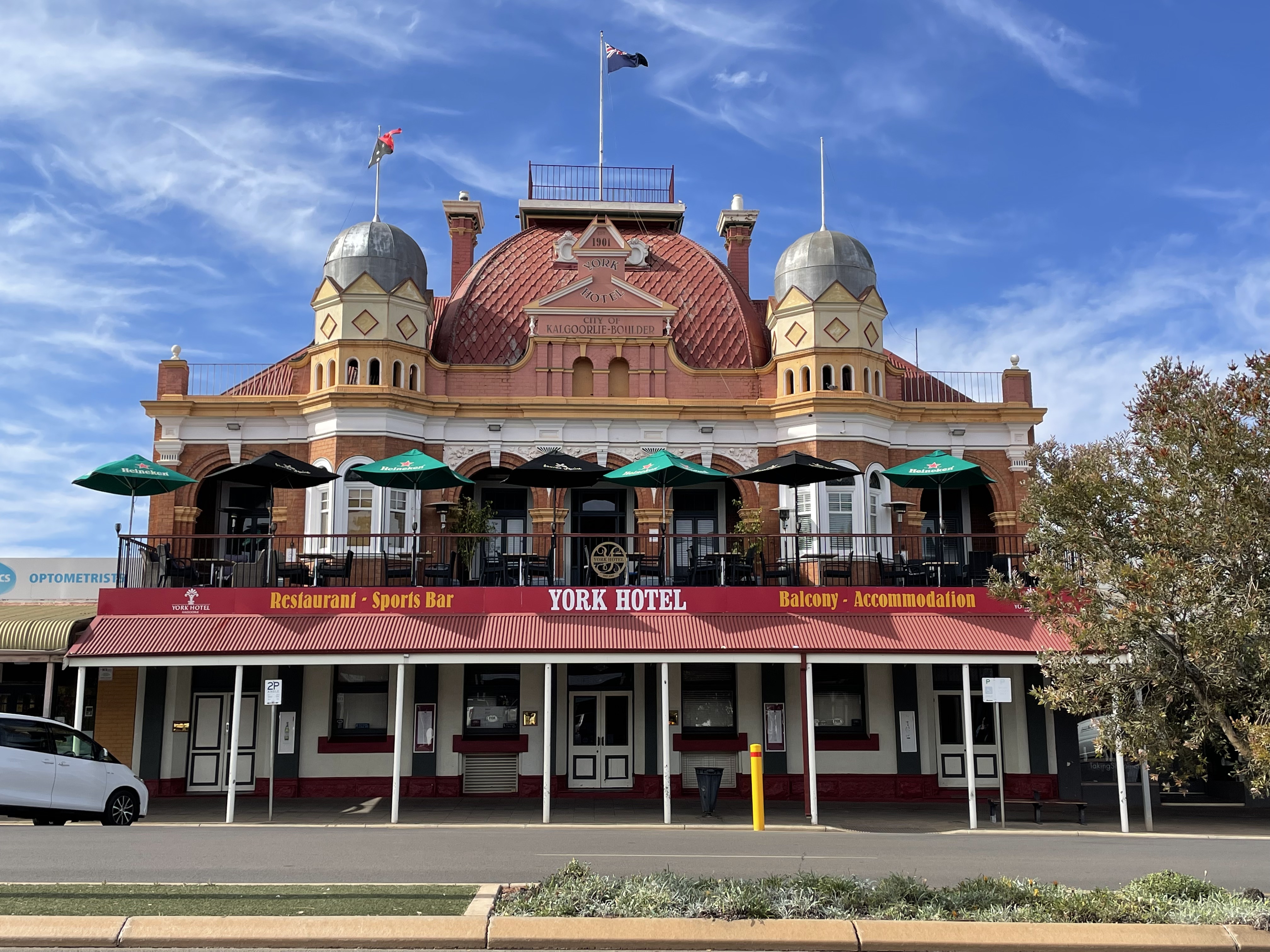
Kalgoorlie/Boulder
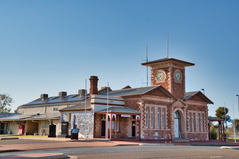
Kalgoorlie/Boulder is a historic area that still produces gold from mines dotted around the region today. It is an interesting place to visit to learn about early exploration and see the workings of today. From all the mines and mining activities, I'd call it the heart of the Goldfields of Western Australia.
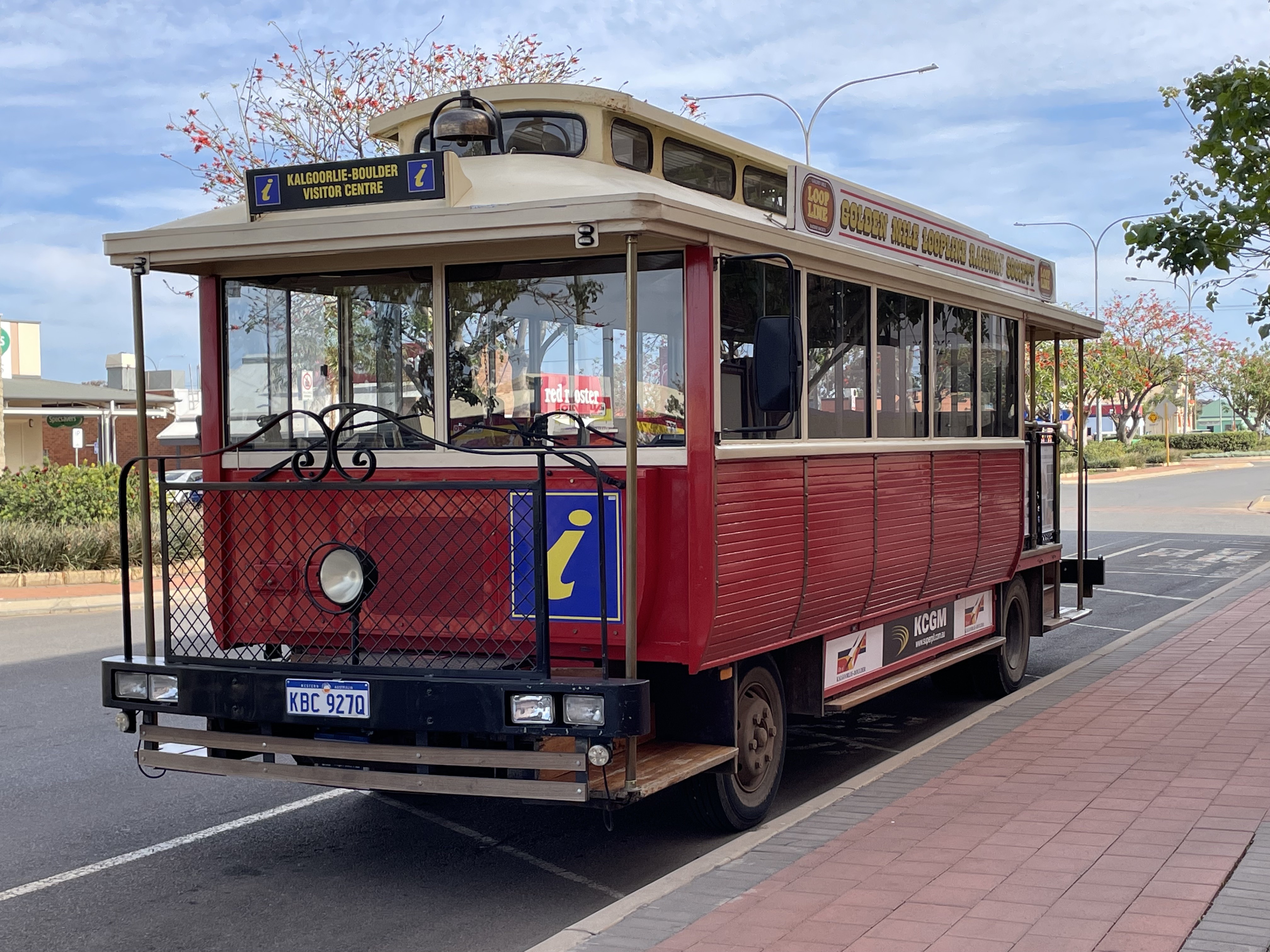
You can take a tour on the tram around Kalgoorlie and Boulder or walk the streets and see the buildings, museums and the statue of Paddy Hannan, who first found gold in Kalgoorlie in 1893 and started the gold rush in the area. Gold is still coming out of the area where he found his riches, and is now called the Super Pit.

The Tour Tram in Kalgoorlie.

Kalgoorlie has old buildings and wide streets.
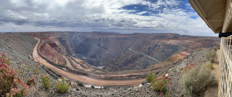
The Super Pit from the Lookout.
Additionally, you can visit The Super Pit, which features a lookout that is free to view, offering a unique glimpse of this enormous hole in the ground. You can see machinery and information on the pit under a shelter at the top.
Where It is
Kalgoorlie is 187 km north of Norseman.
The Super Pit Lookout is on Outram Street, off National Route 94 Alternate, with a large car park at the top.
Kalgoorlie 72-Hour Rest Stop
Right in the heart of Kalgoorlie is the 72-hour rest stop. It's easily accessible but is only for use by RVs or self-contained vehicles, so camping in tents or campers is not permitted.
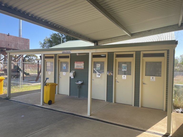
Toilets are here for day use, and there are plenty of bins around and potable water for you to fill water containers.
If you need a coffee fix in the morning, Queen Bee Coffee has a truck serving from 5.30 am. This is a very popular coffee truck, as it serves not only park walkers but also miners' buses taking them to work, so be prepared to wait an extra few minutes for your order.
Where It is
The RV stop is off the highway to Perth at Centennial Park on the corner of Patroni and Hannan Streets. It's 3 km west of the Information Centre on Hannan Street.
Lake Douglas Camping Ground, Kalgoorlie
Lake Douglas camping ground is a vast area with private areas down tracks, where you can get away from everyone or stay together in the central part.
There is a toilet next to the lake and another down in the main camping ground, so if you're not self-contained, don't go too far down the tracks.
There is no drinking water available, so please bring your own. Additionally, plenty of bins are scattered around the central area. Camping is allowed, but there is a 72-hour limit on how long you can stay.
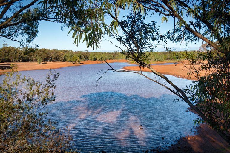
This lake has a walkway around it, and you can camp at the lakeside.
Camping is also allowed beside the lake, with tracks going from the road around the lake. You can also walk around the lake.
Because of the tracks in this recreation reserve, dirt bikes are known to be here, especially on weekends, so watch out for them.
Where It is
Lake Douglas is 15 km west of Kalgoorlie. You have about a 2 km drive down Muncaster Road, a dirt road that is also used by mining trucks. It can be slippery, especially on the steep descent into the camping area.
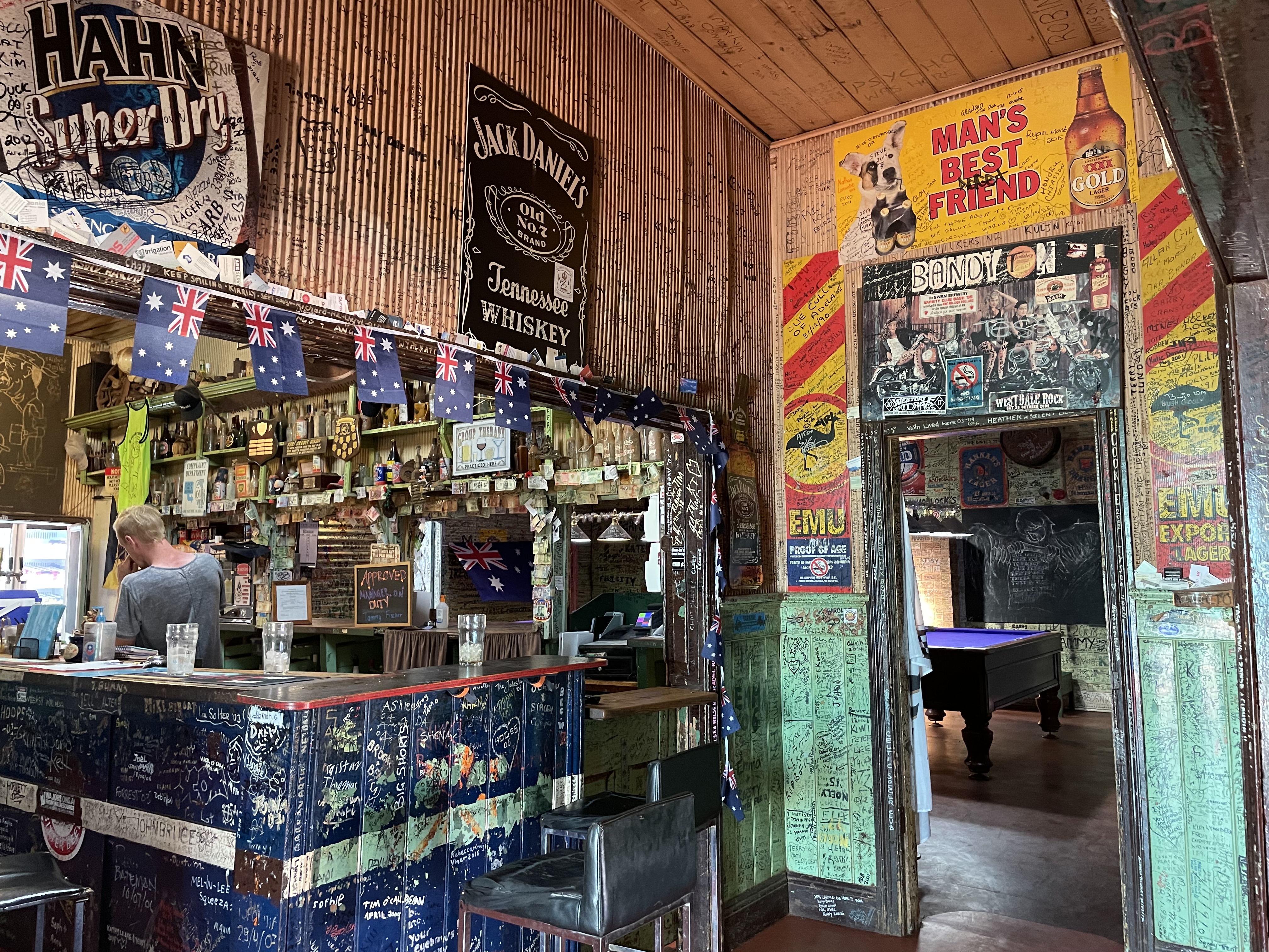
Broad Arrow Tavern and Cemetery
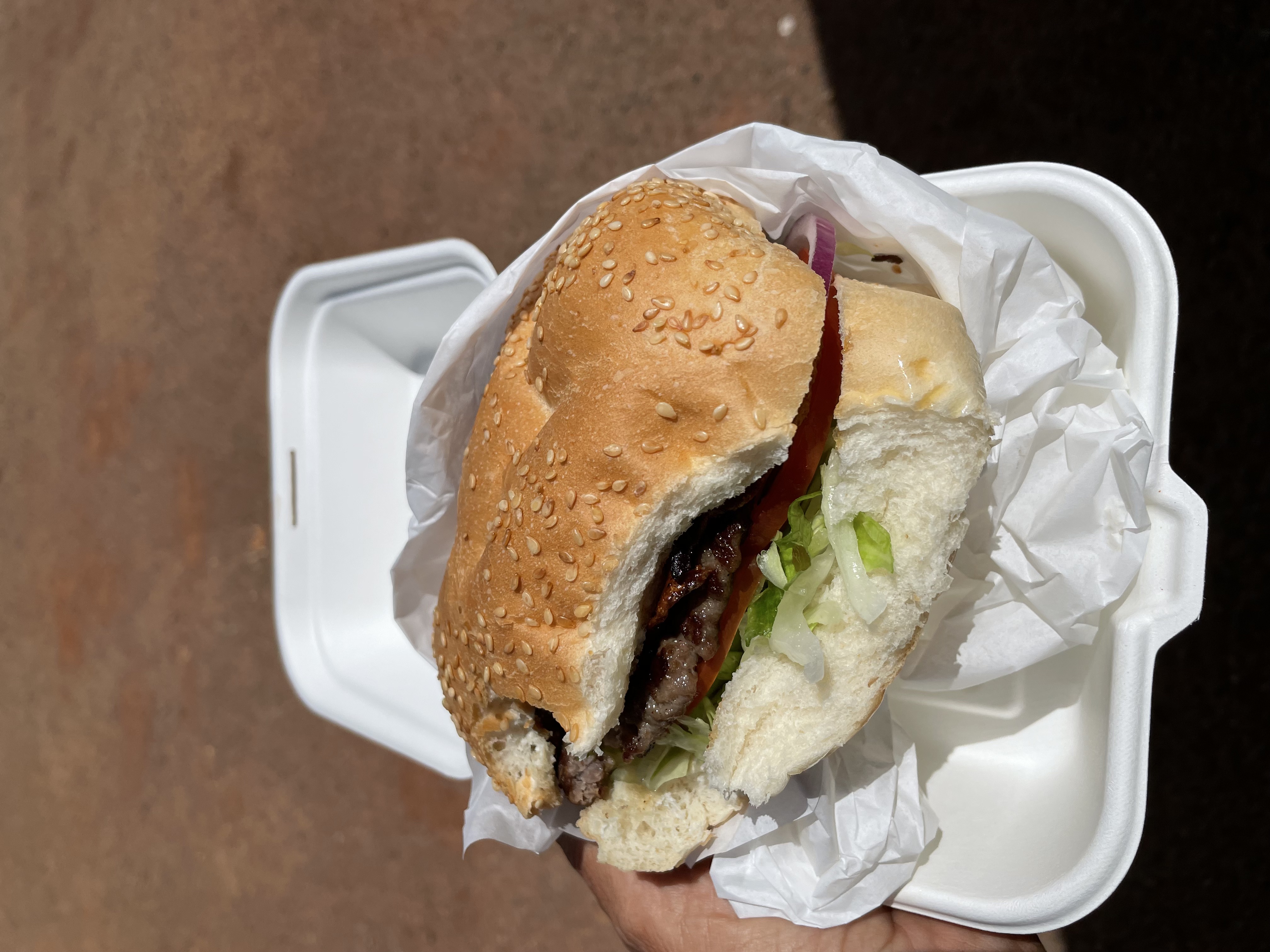
The Broad Arrow Tavern is a popular tourist spot and a great place to take a break and camp. It is famous for its "Broadie Burger" and the inside of the tavern, which customers decorate.
Between 1896 and the early 1920s, this was a bustling town with 15,000 people, eight hotels, a soft drink factory, two breweries, a hospital and a stock exchange.
Now there is just the tavern, and people write on walls and leave souvenirs to mark they've been there.
The Broad Arrow is another stop that's well worth a look.
There is a large car park for whatever type of vehicle you are camping in, and it's also another stop on the Golden Quest Discovery Trail, which is a loop around the Goldfields of Western Australia's history.
No power or drinking water is available, and camping in tents is not permitted.
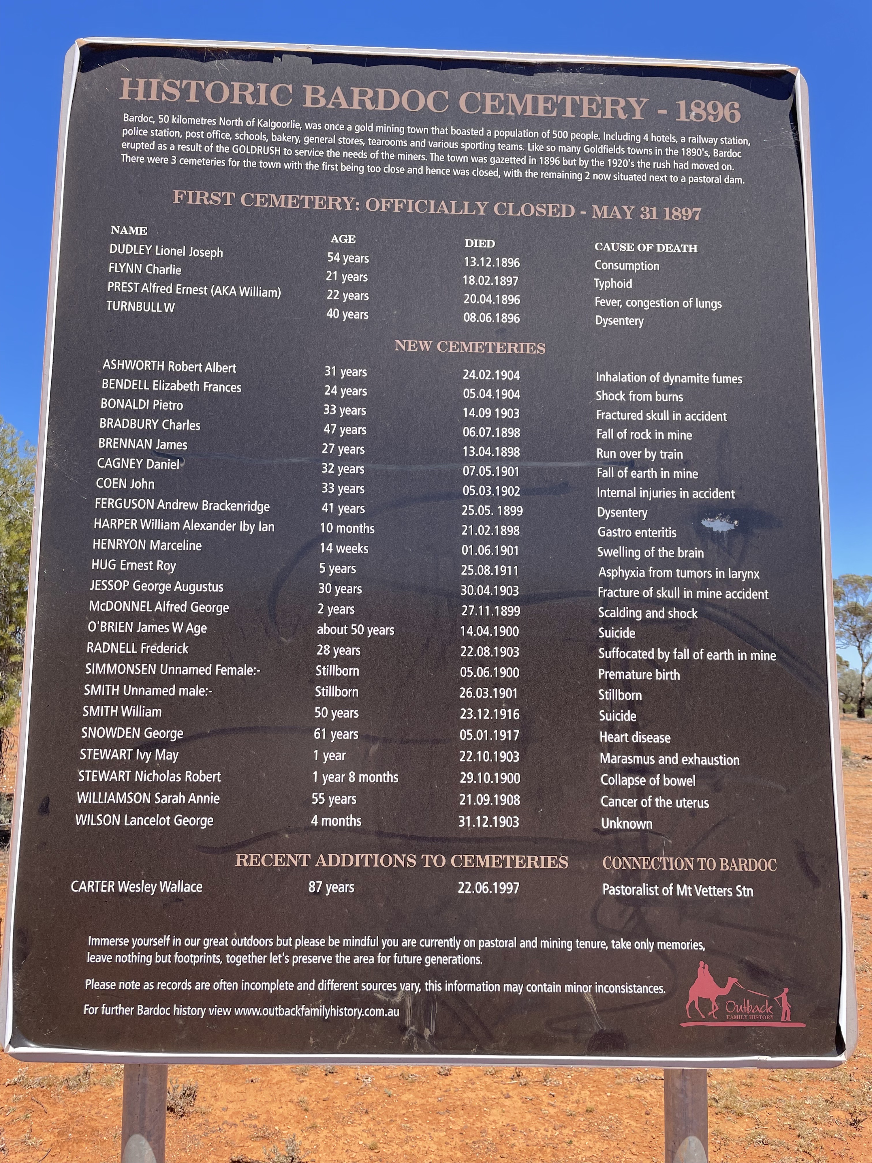
The cemetery is an interesting place to visit, a couple of kilometres up the road. The road is bumpy, and I wouldn't attempt it after a lot of rain, but it is interesting to see, especially how people died.
Where It is
The Broad Arrow Tavern is 39 km north of Kalgoorlie on the Goldfields Highway.
The cemetery is about 3 km north, with signposts leading the way once you go off the Goldfields Highway.
Kambalda West 48-Hour Rest Stop
Kambalda is a handy place to stop and stock up on groceries and fuel.
There is a Woolworths on the corner of Salmon Gum Road and Mistletoe Place, and across the road is the free 48-hour rest stop off Barnes Drive.
Public toilets are at the entrance to the rest area, on the corner of Irish Mulga and Barnes Drives, although these may be locked at night. There is also drinking water and a dump point.
Where It is
The Kambalda West 48-hour is at 15 Barnes Drive. It's 58 km south of Kalgoorlie.
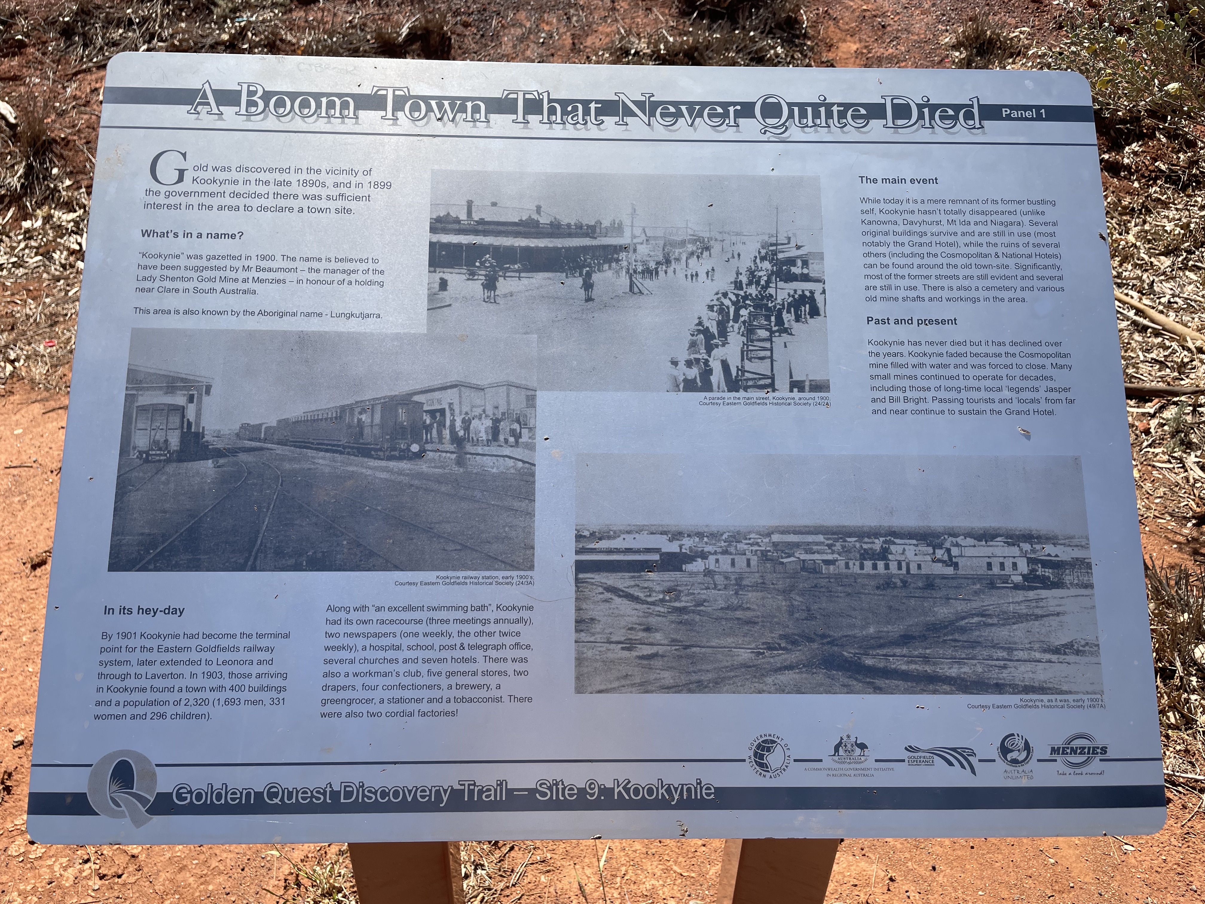
Kookynie and Lake Niagara Camping Ground
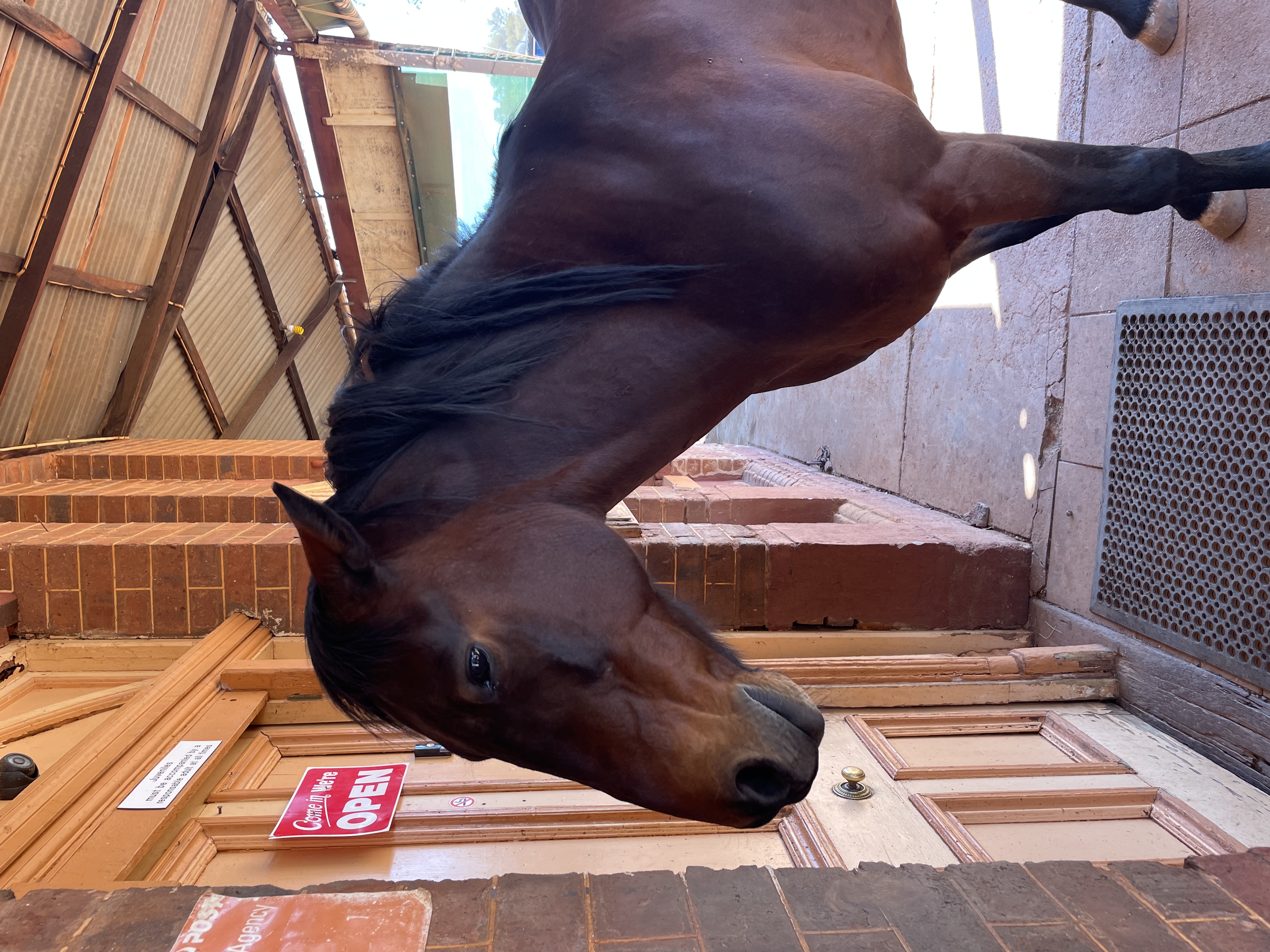
Kookynie is a ghost town apart from the Grand Hotel, built in 1902, and its resident, Willie the horse.
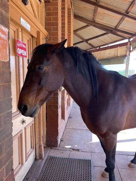
Tourists flock, especially families with kids, to see Willie and give him a pat as well as another friend he has with him. Camping is also allowed at the Grand Hotel Caravan Park with full facilities.
Kookynie is also part of the Golden Quest Discover Trail, a 965 km heritage trail looping the goldfields.
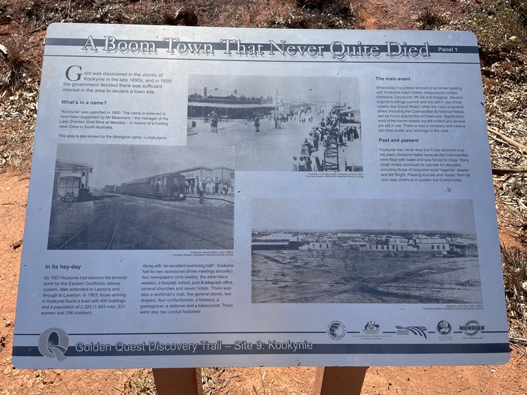
Information boards, throughout the town, tell you the story of the historical side of the town.
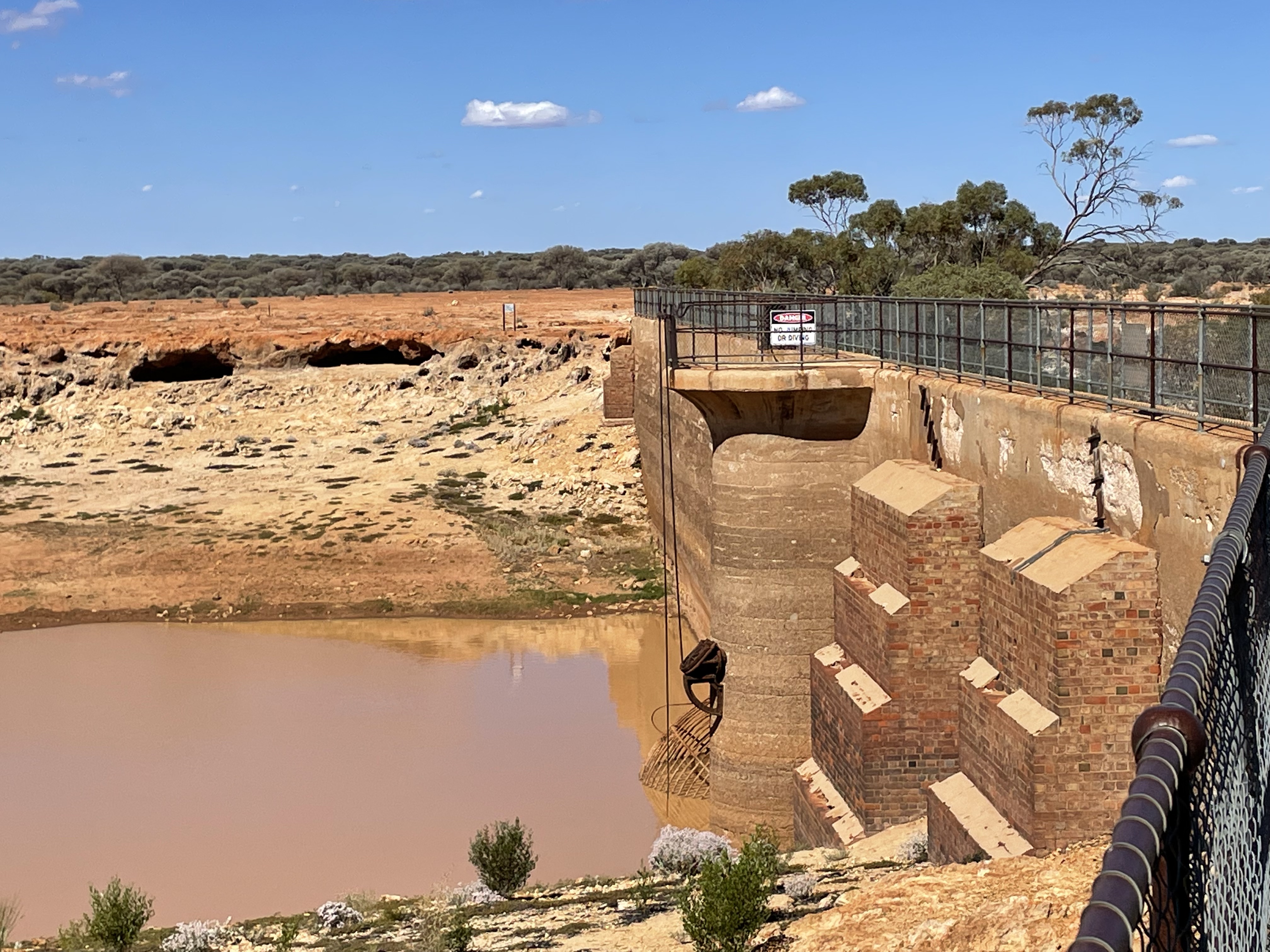
You can also camp at Niagara Dam, another ghost town. This free campground features toilets, bins, and a dump point, but does not offer drinking water. It is another large area with shady areas and walking tracks to explore.
Where It is
Kookynie is 197 km northeast of Kalgoorlie or 66 km northwest of Menzies.
Niagara Dam is 60 km northeast of Menzies or 12 km from Kookynie.
The Grand Hotel is at 54 Britannia Street.
Laverton Caravan Park
Laverton is the start of the Longest Shortcut Road, a mostly dirt road that goes to Alice Springs and then onto Winton in Queensland. It is also a stop for gold prospectors to try to find their fortune.
Its caravan park has all the amenities you would expect, and another key point is it's located behind a secure gate. Cabins and powered and unpowered sites are available.
Sunrise Laverton Caravan Park.
Where It is
Laverton is 359 km northwest of Kalgoorlie. The caravan park is on Weld Drive.
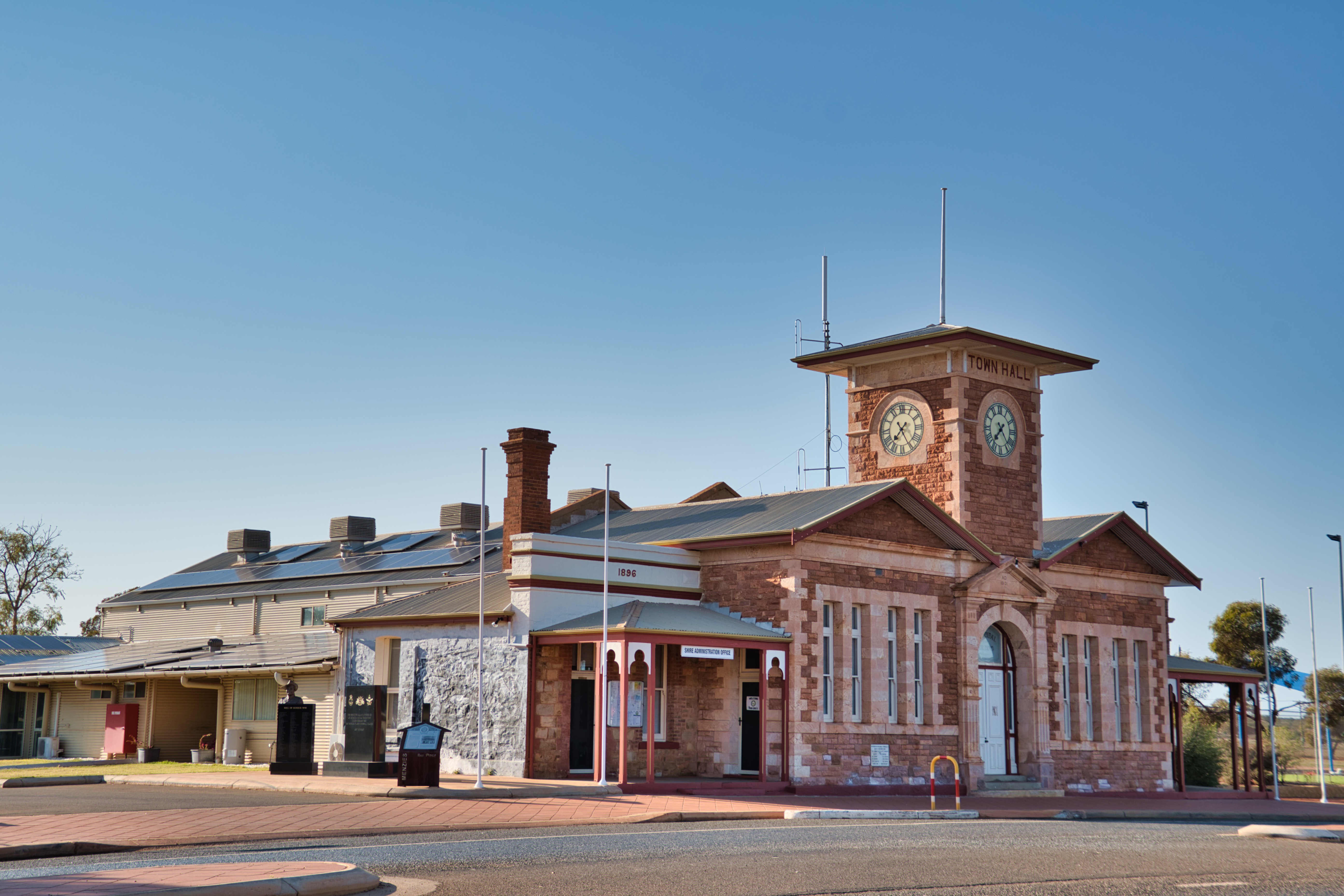
Menzies Caravan Park
For Menzies Caravan Park, you can either pay at the information centre or, if that is closed, there is a locked box in the kitchen where you can fill out a form and leave either cash or card details.
This is also an excellent town for sculptures that mark the gold pioneering history of the town, as well as Aboriginal habitation.
Information Centre for camping at Menzies.
Council Building Menzies.
Site 6 on the Golden Quest Trail.

The Cameleer, Menzies.
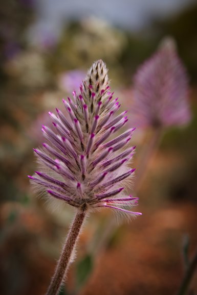
Wildflowers are abundant during the spring months.
There is a small general store located in the hotel (accessible via the entrance on Brown Street). Although it offers fundamental supplies, it's recommended to bring your own essentials.
I haven't been to Lake Ballard Salt Lake, but I do know it is another place to see more sculptures, and there is a campground. There is no potable water, but you do have toilets, bins and a dump point. It does get muddy after rain.
Where It is
Menzies is 131 km north of Kalgoorlie. The Caravan Park is behind the information centre on Shenton Street. The entrance is off Brown Street.
Lake Ballard (with its own campground) is 53 km northwest of Menzies.
Westonia 48-Hour
This little pull-off area in front of St. Luke's Church is where you can park for up to 48 hours.
There are no toilets here, but there are public toilets down the road on Cement Street.
Bins, a picnic table, and a shelter are here.
The Westonia Co-Op and Cafe have good food at reasonable prices.
Where It is
Westonia is 3 hours west of Kalgoorlie. It is 650 m on the left-hand side of the main street as you enter the town.
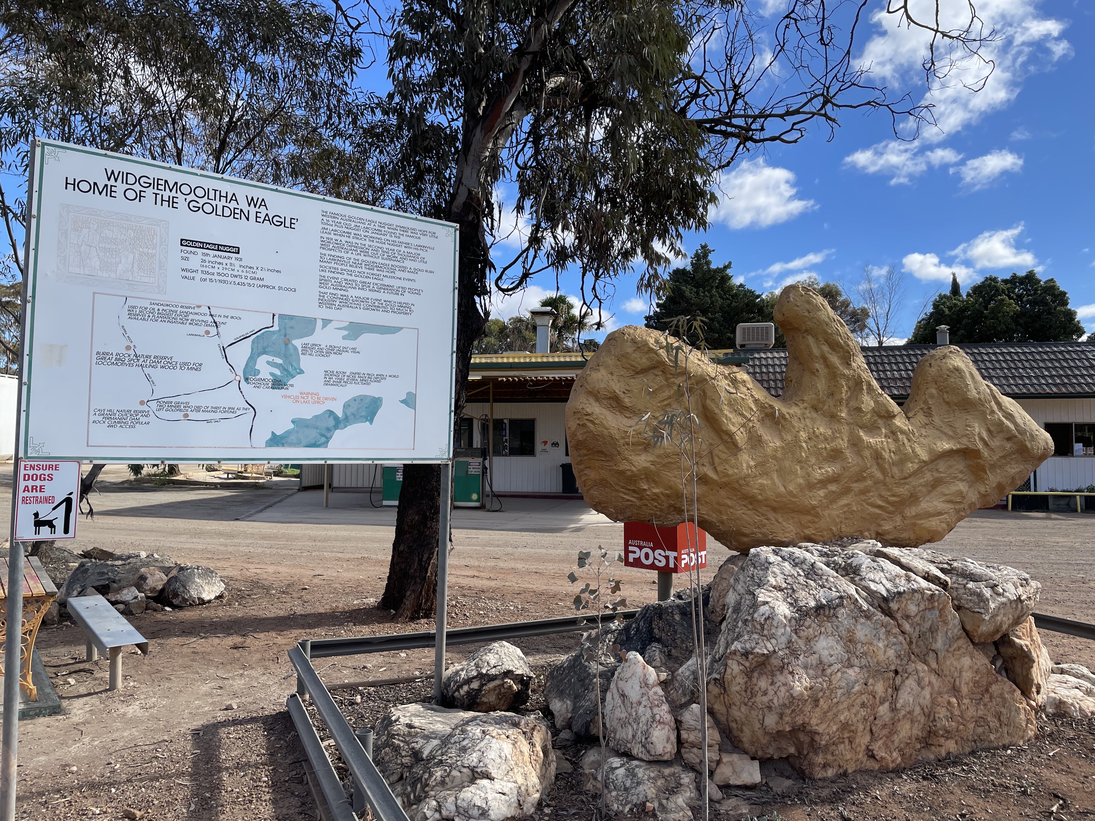
Widgiemooltha Roadhouse
I have included this one just as a tourist stop.
Home of the Golden Eagle Nugget, it was found by a 17-year-old on 15 January 1931. Weighing 1,135 oz or 32.2 kg, it was the largest seen at the time and started a gold rush in the area.

Home of the Golden Eagle Nugget.
Where It is
The Widgiemooltha Roadhouse is on the corner of Kingswood Street and the Coolgardie-Esperance Highway. It's 90 km north of Norseman and 97 km southwest of Kalgoorlie.
Wildlife
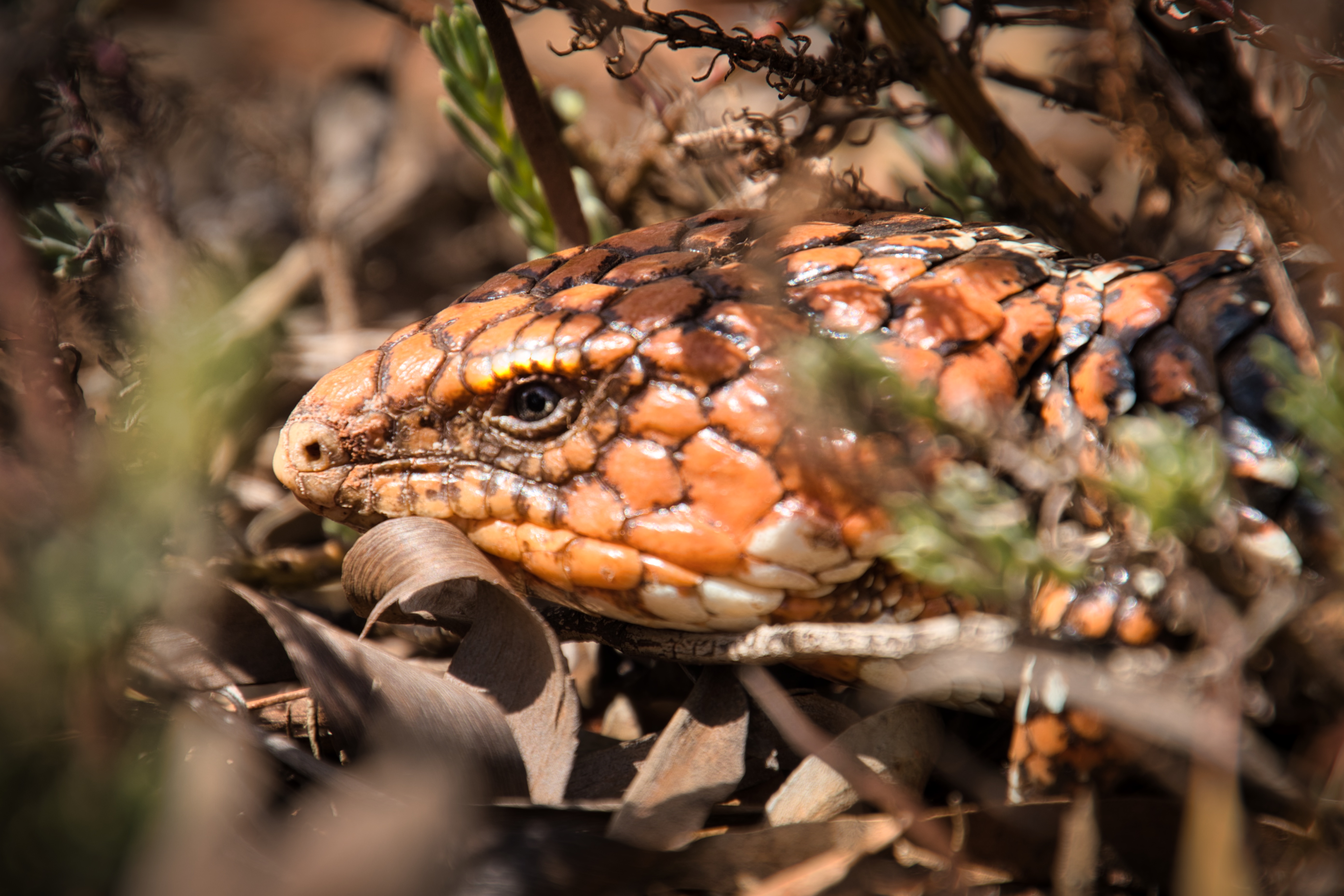
If you expect to see wildlife in this area, you will probably be disappointed.
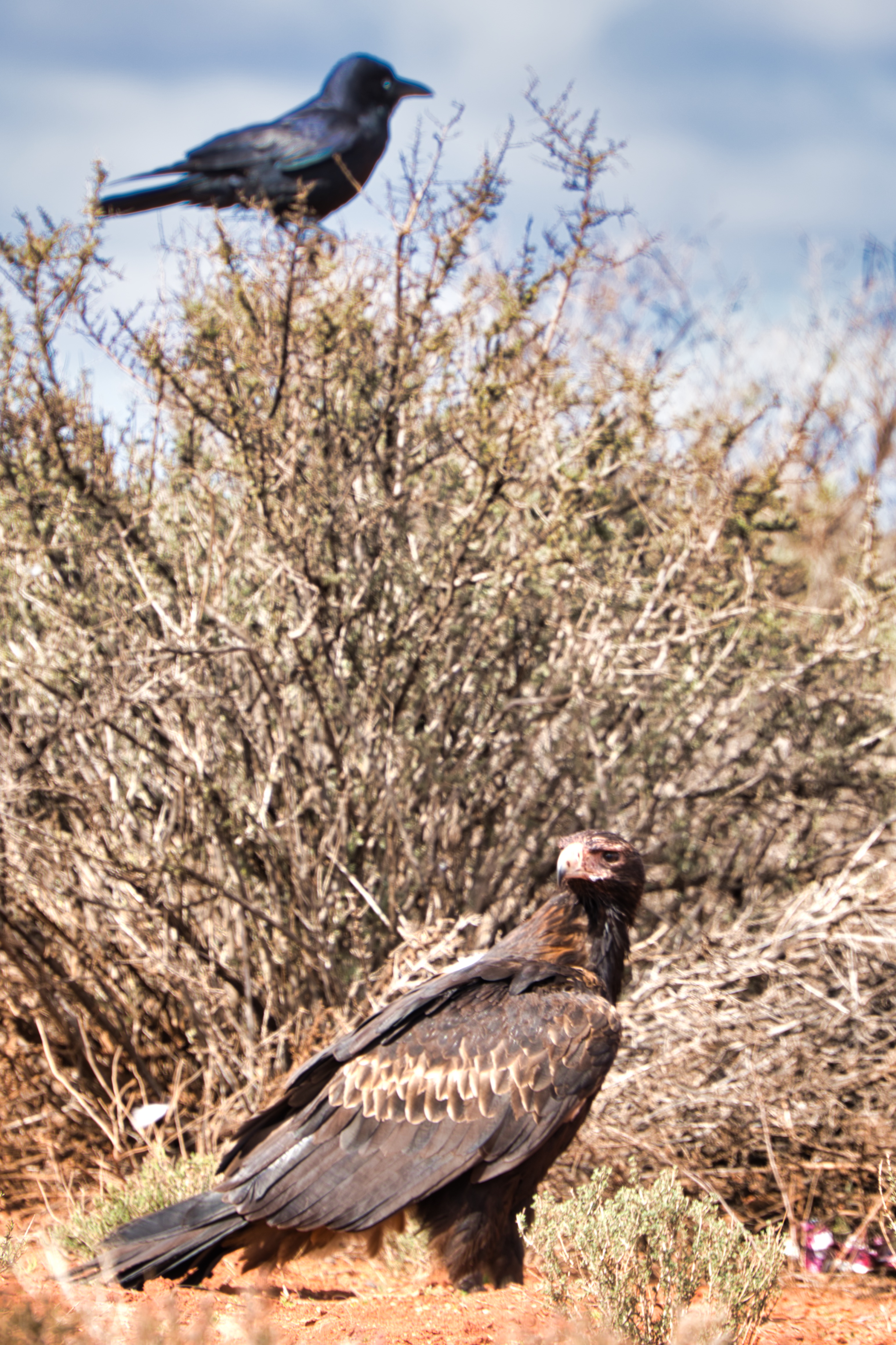
In the seven months that we were there, we saw one Kangaroo in the Laverton Hospital car park, two Shinglebacks and a few Wedge-tailed Eagles feasting off a dead cow.

Another local of the Western Australia outback.
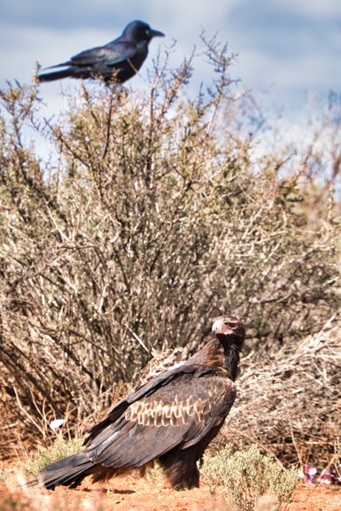
Wedge-tailed Eagle and Crow.
South of Norseman Camping & Rest Areas
Bromus Dam Camping Ground
Once again, you have a large area full of many tracks where you can be as close or far away from anyone.
This free camping ground features a toilet, numerous bins, shady spots, and numerous walking tracks. You can also pitch a tent here, and there's no time limit.
It will become slippery after rain, so take care, as it's a dirt track and quite bumpy.
Where It is
Bromus Dam is 32 km south of Norseman on the Coolgardie-Esperance Highway. It is well-signposted.
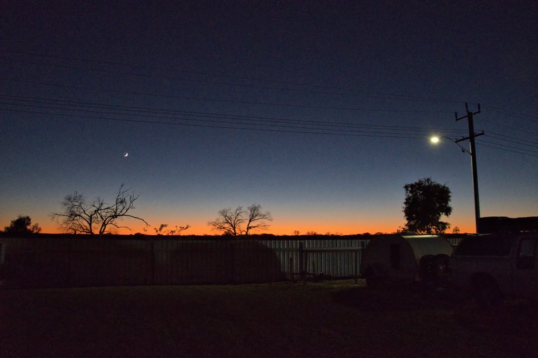
Kumarl Rest Area
This free 24-hour rest area at Kumarl is open to everyone, including those with tents.
There are plenty of bins, shady spots, picnic tables and private areas to park away from everyone else. Unfortunately, there are no toilets, but the sunsets are glorious.
The big open rest area.
Where It is
Kumarl rest area is 74 km south of Norseman and 130 km north of Esperance. There is a signpost on the Coolgardie-Esperance Highway directing you.
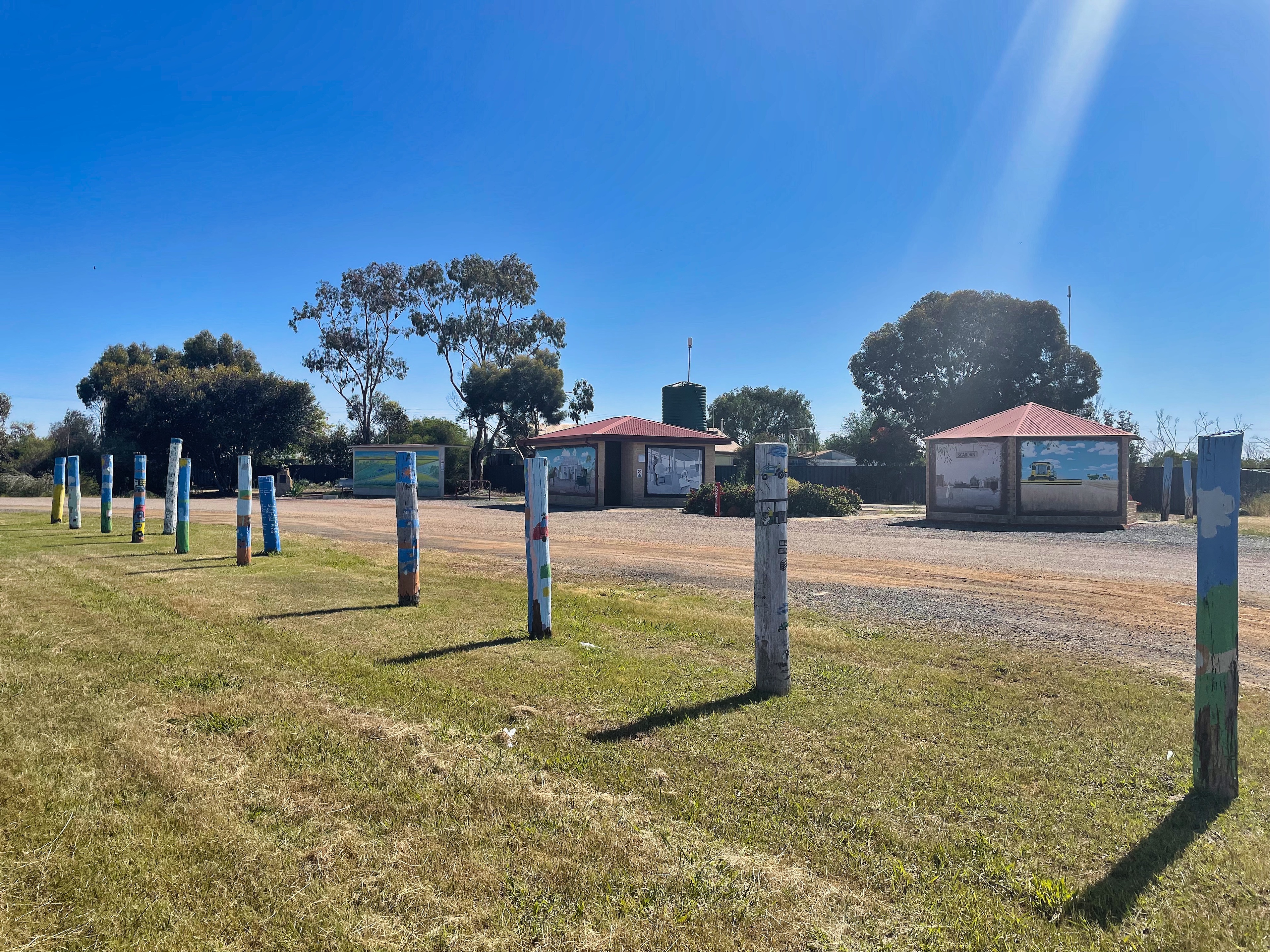
Pioneer Park, Scaddan
Pioneer Park in Scaddan is a great place to stop, use the toilets and see the art painted on the walls and mosaics in the pathways.
Where It is
Pioneer Park is 150 km south of Norseman and 53 km north of Esperance on the Coolgardie-Esperrance Highway. You do come upon it quickly, so keep an eye out on the north side of town.
Salmon Gums for Free Hot Showers
When you're on the road and don't have a shower at hand, finding free showers, especially hot and free showers, is fantastic.
The disabled toilet, where the shower is located, features a large wet area shower that is kept clean. There is also a changing table, which is great for leaving your towel and clothes on.
The toilets and a shower are available in town.
Where It is
As you pass through Salmon Gums, you'll find a sign for toilets on the Coolgardie-Esperance Highway. It's 97 km south of Norseman and 107 km north of Esperance.
Conclusion
I hope that you get out and enjoy the Goldfields region of Western Australia and that this blog has been of help to you. There is much to see and do in the Goldfields of Western Australia, and no better way of seeing it than camping and on a road trip. Hopefully, you get the chance to sample it for yourself.


