British Columbia sees a part of the famous Rocky Mountains chain crossing its province. As a result, mountains surround the Vancouver area. While I was living in the wonderful Canadian city, I had the opportunity to venture on some unforgettable hikes around the region. Let me present to you the best hikes in Vancouver.
Grouse Mountain
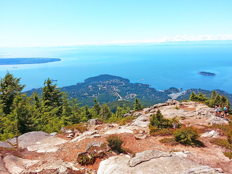
Firstly, The most popular one is called Grouse Grind and takes you to the Peak of Vancouver. Grouse Mountain is located across Vancouver, only 20 minutes from Downtown, at the top of North Vancouver city. As it is a very famous hike, I remember taking a free shuttle bus from Vancouver Downtown once a week during summer time. The hike trail is probably one of the steepest I’ve experienced as many staircases are set along the way to guide hikers. The average time to reach the top is between 1h to 1h15. An interesting feature is the clock in timetable present at the top for Grouse Mountain members to check in each time they visit. On one hand, some people use the trail regularly as a pure fitness training in order to keep in shape. On the other hand, a cable car operates carrying visitors and tourists to the top to enjoy some leisure time and experience the view. In fact, the Peak of Vancouver offers you the best view of the city, the ocean and on a very clear sky a view all the way to the US border. Moreover, the main attraction of Grouse Mountain is the 2 grizzlies occupying the place. You will also find the typical lumberjack contest and a pleasant trail in between native American totem poles. When reaching the top, if you didn’t have enough, small hikes will take you further in the mountain such as Goat Mountain and Goat Ridge.
Cypress Mountain
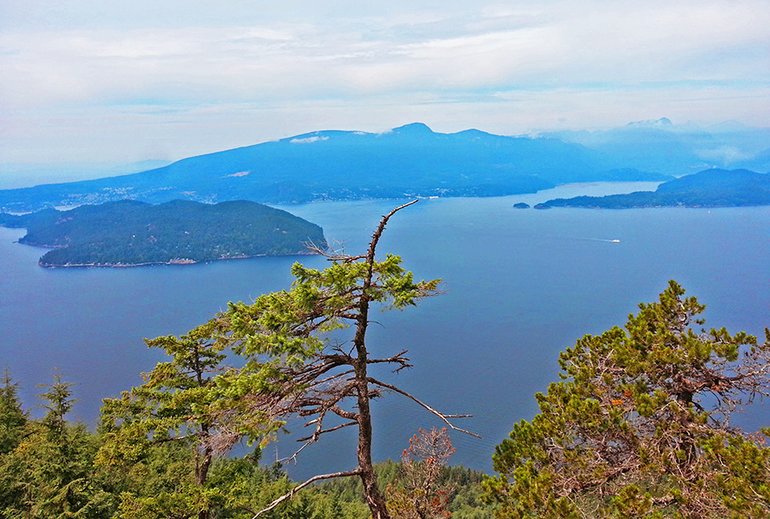
“Here you are in front of spectacular scenery with Bowen Island and Horseshoe Bay in front of you and Vancouver off your left”
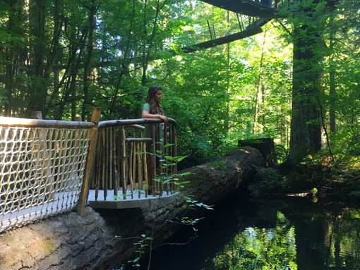
Eagle Bluff
Eagle Bluff ski slopes
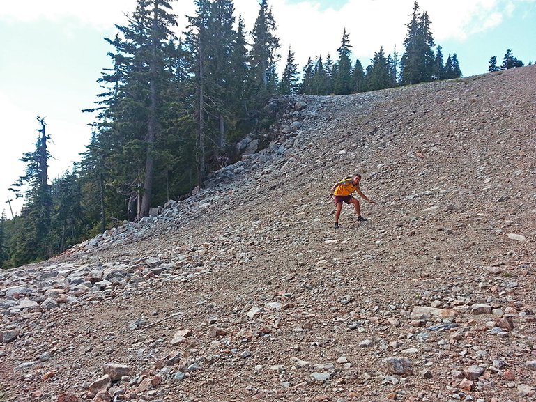
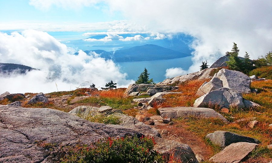
Second, Eagle Bluffs hike at Cypress Mountain will offer you more variety as the trail is made of rocks, gravels, grass, forest paths and small lakes. Cypress is situated next to Grouse Mountain on the westernmost side of the North Shore. The hiking trail usually starts at the downhill ski area, which is about 45 minutes’ drive from downtown. As mentioned earlier, this hike brings variations of terrains. Therefore, some parts of the trail use the winter ski slopes wide open covered with rocks and gravels. This steep section of trail enables you to quickly gain elevation. Fortunately, many viewpoints along the way allow you to take a break. Indeed, if you look around you, you will be able to admire great views of the Lions and Brunswick Mountain. In the opposite direction, Bowen Island and the southern tip of the Sunshine Coast are visible in the distance. Besides, you will encounter several small lakes, as you make your way up hill, such as Cabin Lake, Yew Lake, Owen Lake and Cougar Lake. The last part of the 4 hours hike takes you to a trail through a forest of pine trees. Few minutes later, “the end of the tunnel” as sun shines through the trees and opens up to the majestic view. Here you are in front of spectacular scenery with Bowen Island and Horseshoe Bay in front of you and Vancouver off your left. The spot is perfect to enjoy a picnic on a rock with this incredible view. To sum up, I strongly recommend this hike with intermediate difficulty and clearly marked trail signs.
Squamish
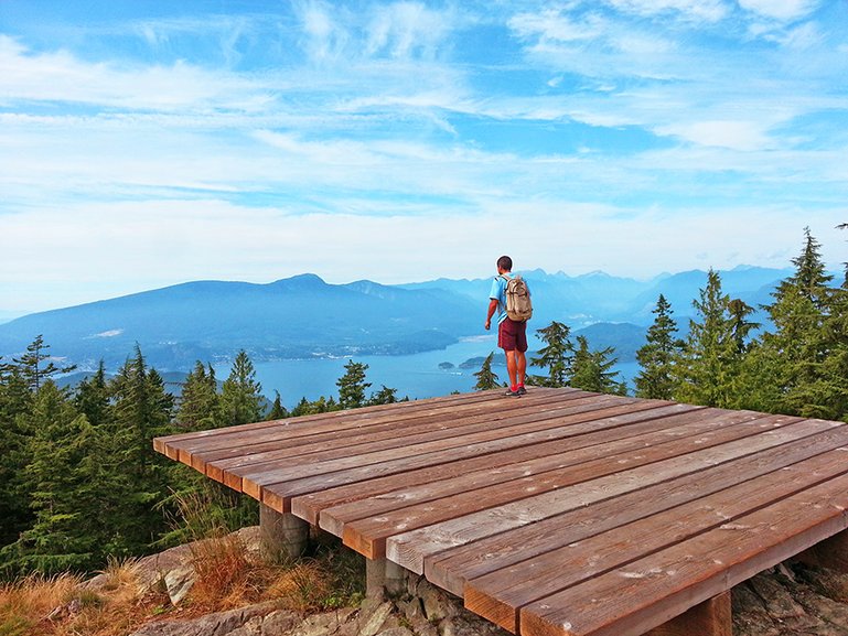
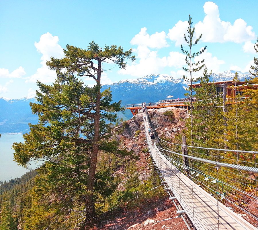
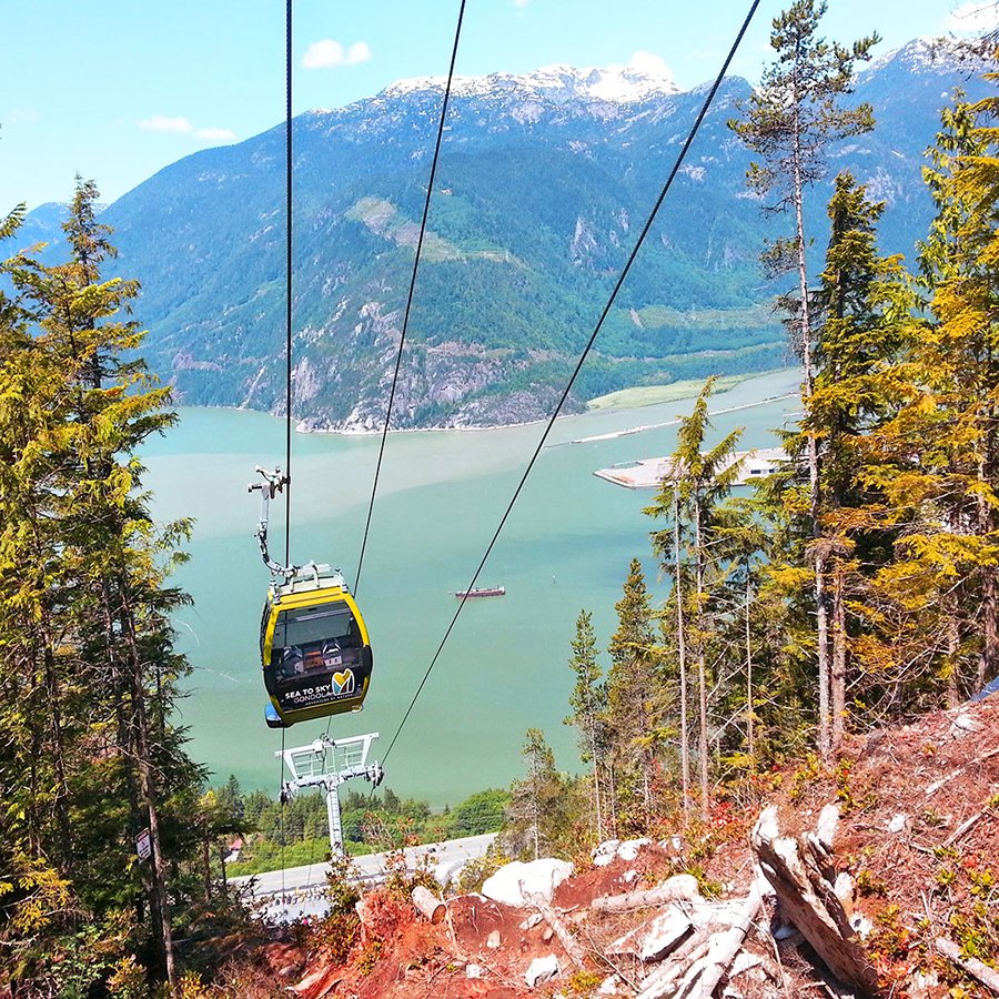
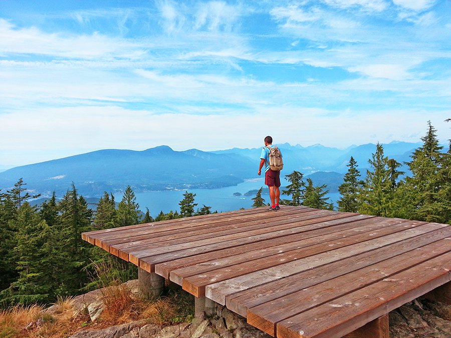
Third, also very popular in the region, the city of Squamish offers a variety of multi-level difficulty hikes. The location is a little bit further north on the way to Whistler about 1 hour and half from Vancouver. Before getting to Squamish, you realize that your adventure will be rich for your eyes as you drive on the Sea to Sky Highway. Probably the most memorable drive I can think about with ocean, mountains and forest all around you! As you reached Sea to Sky Gondola parking lot, several options are available:
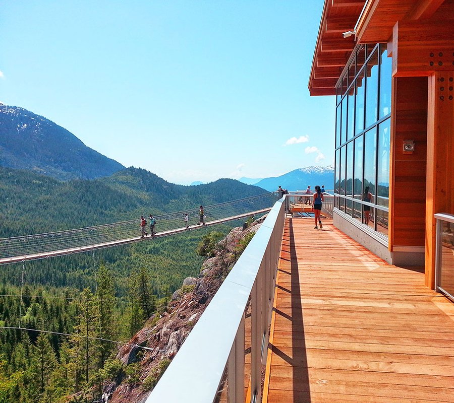
As its name mentions it, the easiest way to get to the top of the rock is using the cable car. This is a very touristic attraction with a picturesque suspension bridge and a modern café restaurant overlooking the valley.

Suspension bridge at Sea to Sky Gondola

Sea to Sky Gondola

Suspension bridge
Some inbound trails will suit occasional hikers who are looking for easy hikes between 30 minutes to 2 hours.
Backcountry trails offer more adventure and advanced hikes with some challenging parts. They will allow you to explore beyond the summit with different viewpoints over the surrounding mountains. These trails are between 6km to 24km long and take from 3 to 8 hours to achieve.
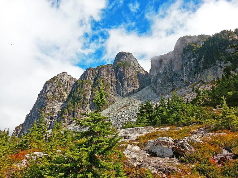
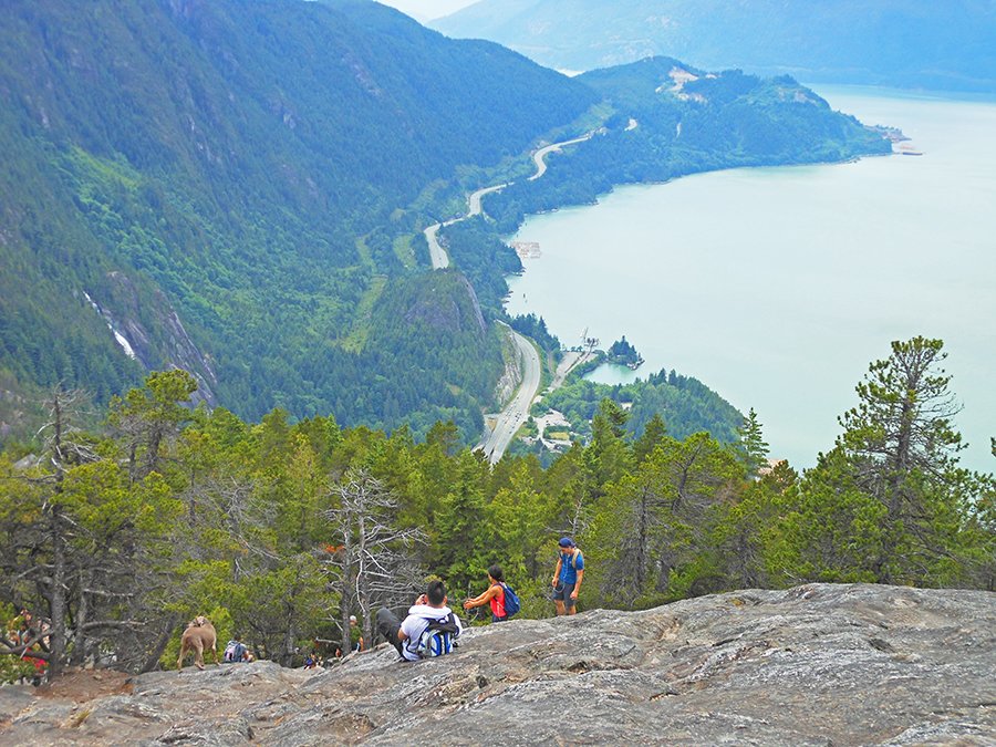
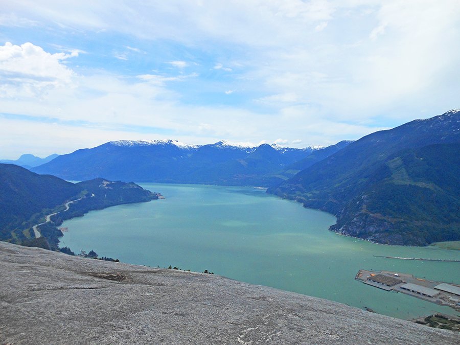
Then, the Stawamus chief hike is part of the must do trails list in the region. The departure location can be found at the Sea to Sky Gondola or another parking lot further down on the right. The hike to the three peaks is steep and could be challenging but it is possible to climb all three in the same day. Where help and assistance are required at some point, there is nothing to worry as ladder and chains are available on the trail. All three summits offer rewarding views of Squamish’ surrounding area including Howe Sound and north to Garibaldi Provincial Park.

First peak, The Chief

First peak, The Chief
The Lions Peaks
“Having lunch next to the Lions, above the clouds, remains once in a lifetime memory”

West Lions, Lions Bay
The Lions Peaks
Fourth, reach the two most popular natural landmarks seen from Vancouver city using The Lions Binkert trail. As a result, the panoramic lookout at the top of the Lions Peaks offers a breath-taking view of Howe Sound and the Capilano valley all the way down to the city of Vancouver. Bear in mind that this hike requires a strenuous effort in order to be able to earn a well-deserved rewarding view. In fact, the round trip hiking trail is 16km long and takes around 8 hours. The walk starts at Lions Bay, passed Horseshoe Bay, about 1 hour from Vancouver downtown. The first hour of your ascent will be relatively easy, as the trail remains flat. Take a moment to admire some scenic waterfalls as you travel uphill through a series of switchbacks. However, there is no time to get too comfortable because the hardest part is yet to come. As a result, the rest of the hike is strewn with steepest sections as the terrain goes from dirt trail to rocky path. I remember the one hour long trail through Douglas Fir and Western Red Cedar forests as a difficult part. In fact, we had to climb over rocks, gravels and lot of fallen tree trunks on the way. Having lunch next to the Lions, above the clouds, remains once in a lifetime memory.
Bowen Island
Bowen Island is the closest and the first island visible from Vancouver. In order to get there, drive to Horseshoe Bay and hop on a 45 minutes ferry cruise to reach Snug Cove ferry terminal. The lookout is located at the top of Mount Gardner and can be reached with many different hiking trails. If you took your car with you, a 6km drive will take you to the parking area by following Killarney Lake direction. The trail is about 11km loop and can be done in both ways. It offers a pleasant hike using Skid Trail or North Mount Gardner Trail. However, there’s a lack of signage making it slightly confusing as many junctions and forks are present along the way. The last ten minutes are the hardest part as ropes are available for climbing the steepest sections. And here you are on the summit of Mount Gardner where you can spot two helicopter pads on both sides. Gibsons town on the edge of the Sunshine Coast is overlooked from the westside whereas the east side offers stunning views of West Vancouver and Vancouver Downtown. A daily roundtrip into Bowen Island is totally worth the visit.
Mount Gardner summit
View from Mount Gardner
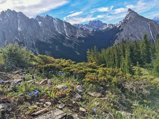
Garibaldi Lake
Garibaldi Lake is a hidden gem nestled in the heart of Alpines Mountain between Squamish and Whistler. When visiting British Columbia, one day spent in this unique and scenic place is a must do activity. Located about 1h45 minutes from Vancouver, don’t miss the Rubble Creek parking lot on your right as you drive North to Whistler. Generally speaking, the hike is not too hard but will be of intermediate difficulty as it’s a 9km long one way. There are no other options but to use the same way to hike back down to the parking lot. The beginning will bring variations of switchbacks and long straight dirt path through Douglas Fir forest. The first 6km seems like an endless trail but are well worth the effort. Taking a right at the first junction will be the shortest way to Garibaldi Lake. Finally, a clearing opens up to a small lake leading to a second larger lake between steep rocky ascents. If you made a left, previously, toward Taylor Meadows, this way will take you to the summits of Black Tusk or Panorama Ridge. I haven’t been all the way up there, but it is definitely on my list as the view overlooking the all Garibaldi Lake is absolutely breath taking. This trail, double distance, requires being equipped as people usually set a tent to camp overnight at the top of the mountain. Anyhow, passed the second lake and you will start seeing some clear turquoise water through the pine trees. Cross the little wooden bridge above the watercourse and you can admire the spectacular view of the beginning of Garibaldi Lake filled with trunks decorating the pristine water. Continue on the narrow path for another five minutes before to get to the picnic area in the heart of the lake. After a long effort, take some time to enjoy this unique reward by diving into the water. Keep in mind that the temperature is cold as the pure water gets its source from the glacier seen on the backdrop. I remember doing the ice bucket challenge, which was the trend on social networks back then. This incredible view of the snow summit while you are swimming into the lake brings you a once in a lifetime experience.
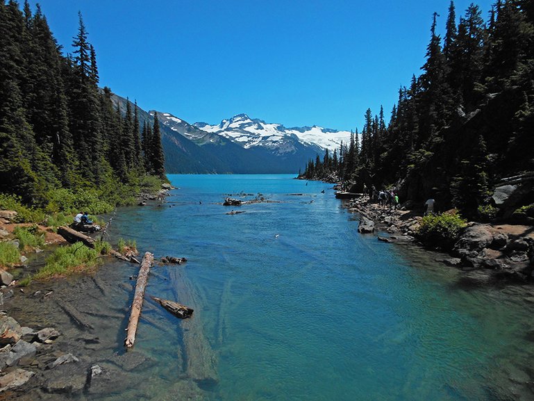
Garibaldi Lake
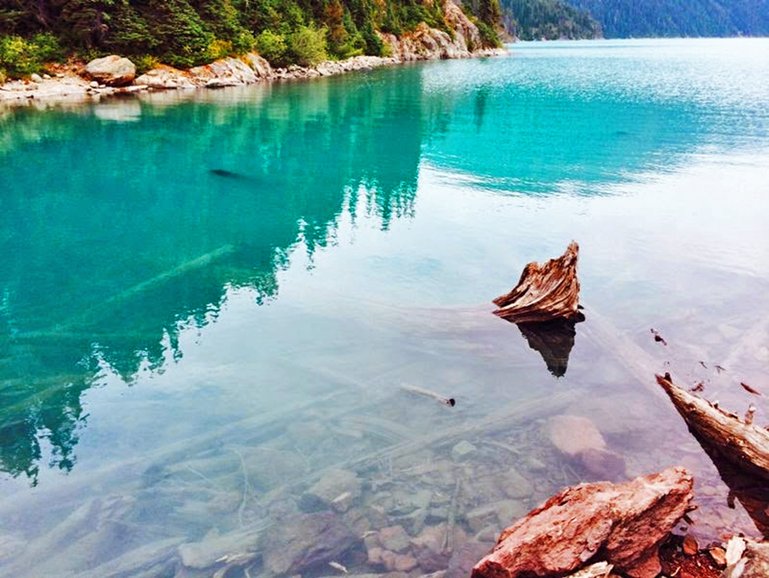
Pristine water at Garibaldi Lake
I hope this blog post will give you some good reasons to visit British Columbia as I tried to cover the most popular and best hikes in Vancouver area. Few other shorter trails closer to Vancouver offer peaceful and pleasant views so I recommend you to stay tune for our next blog post about Vancouver (WORK IN PROGRESS…)


